Category:'s-Herenstraat 48, Maasland
Jump to navigation
Jump to search

| Object location | | View all coordinates using: OpenStreetMap - Google Earth - Proximityrama |
|---|
 | |||
| Upload media | |||
| Instance of | house | ||
|---|---|---|---|
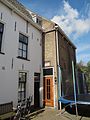
| Location | Maasland, South Holland, Netherlands | ||
| Street address |
| ||
| Heritage designation |
| ||

| |||
| |||
|
This is a category about rijksmonument number 26574 |
Address
| 's-Herenstraat 48 Maasland Netherlands |
Media in category "'s-Herenstraat 48, Maasland"
The following 3 files are in this category, out of 3 total.
 Maasland - 's Herenstraat 48.jpg 1,944 × 2,592; 1.23 MB
 Overzicht - Maasland - 20144636 - RCE.jpg 1,200 × 810; 174 KB
 Overzicht - Maasland - 20144637 - RCE.jpg 1,200 × 947; 231 KB

