Category:Archaeological sites
Jump to navigation
Jump to search

place (or group of physical sites) in which evidence of past activity is preserved  | |||
| Upload media | |||
| Subclass of | find spot, human-geographic territorial entity, venue | ||
|---|---|---|---|
| Facet of | cultural heritage | ||
| Different from |
| ||
| |||
Subcategories
This category has the following 33 subcategories, out of 33 total.
*
?
A
C
E
G
H
I
M
N
O
P
S
T
V
~
Pages in category "Archaeological sites"
The following 6 pages are in this category, out of 6 total.
Media in category "Archaeological sites"
The following 131 files are in this category, out of 131 total.
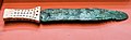 Bronze Age Dagger.jpg 5,757 × 1,797; 5.63 MB
 Castro de Vigo-1.jpg 3,354 × 2,152; 1.72 MB
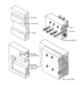 Chacoan wall features by Stephen H. Lekson.png 857 × 902; 232 KB
 Chan Chich Site Map.png 1,430 × 1,103; 206 KB
 Chan Chich Vessels.png 655 × 572; 608 KB
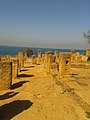 Cherchel.jpg 1,920 × 2,560; 3.46 MB
 Ciudadela de trinchera.jpg 1,360 × 750; 474 KB
.JPG/120px-Cojines_del_Zaque._Vista_actual_(2015).JPG) Cojines del Zaque. Vista actual (2015).JPG 4,000 × 3,000; 4.13 MB
Cojines del Zaque. Vista actual (2015).JPG 4,000 × 3,000; 4.13 MB
 Col Rosson seen from Quaterna.jpg 1,500 × 994; 473 KB
 Cova Negra.jpg 563 × 353; 79 KB
 Cueva en Gobas de Laño.jpg 600 × 399; 78 KB
 Cueva-iglesia de Santorkaria 250 px.jpg 250 × 166; 92 KB
 Deir el-Bachit Schlafzelle.jpg 866 × 650; 118 KB
 Ein Samia aqueduct.jpg 4,000 × 3,000; 4.78 MB
 Gateway of India by me.jpg 3,648 × 2,432; 1.66 MB
 Gilgal of Benjamin.jpg 1,500 × 842; 1.59 MB
 Goi Erdi Aroko metalezko pieza Lantoron gazteluan aurkitua.jpg 4,608 × 3,456; 1.55 MB
 Gugur.jpg 366 × 206; 19 KB
 Il sito delle fornaciP 20150524 091309 HDR.jpg 2,560 × 1,920; 1.39 MB
 Information board by Archaeological Suvery of India at Mudhai temple.jpg 960 × 1,280; 235 KB
 Inside Potocka zijalka.jpg 1,024 × 661; 183 KB
 Katillegiko lepoa 1 tumula.jpg 4,320 × 3,240; 2.92 MB
 Katillegiko lepoa 2 tumulua.jpg 3,807 × 2,535; 2.07 MB
 Khirbet el-Mastarah.jpg 2,048 × 1,536; 758 KB
 Kilmore Standing Stones.jpg 4,741 × 2,977; 1.18 MB
 L'un des bassins du Chastel de Taintrux.JPG 1,024 × 681; 220 KB
 L1020822.JPG 4,000 × 3,000; 5.15 MB
 Lamiñak-II-Berriatua.jpg 527 × 794; 683 KB
 Lanhill Long Barrow Plan.jpg 2,832 × 2,264; 4.07 MB
 Le Mura - panoramio.jpg 3,456 × 2,592; 2.21 MB
 Letecky pruzkum.jpg 878 × 573; 281 KB
 Loma Alta Ball Court 1.jpg 4,032 × 3,024; 7.62 MB
 Loma Alta Circle A panorama.jpg 9,030 × 1,876; 5.33 MB
 Loma Alta Circle A.jpg 3,264 × 2,448; 1.63 MB
 Loma Alta Circle B.jpg 3,264 × 2,448; 1.93 MB
 Los Guachis Ball Court 1 panorama.jpg 11,874 × 1,790; 5.99 MB
 Los Guachis Ball Court 2 panorama.jpg 8,694 × 1,882; 3.63 MB
 Los Guachis Circle 1 panorama.jpg 8,696 × 1,864; 5.6 MB
 Los Guachis Circle 2 above.jpg 6,000 × 4,000; 14.28 MB
 Los Guachis Circle 2 panorama.jpg 9,378 × 1,808; 4.57 MB
 Los Guachis Circle 3 panorama.jpg 12,056 × 1,910; 7.69 MB
 Los Guachis Circle 4 above.jpg 6,000 × 4,000; 14.74 MB
 Los Guachis Circle 4 panorama.jpg 30,774 × 2,841; 48.64 MB
 Los Guachis Circle 6 above.jpg 6,000 × 4,000; 11.83 MB
 Los Guachis Circle 6.jpg 6,000 × 4,000; 13.3 MB
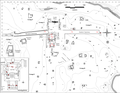
 Los Guachis site map.jpg 2,448 × 3,264; 966 KB
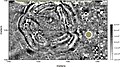 Magnetic image of council circle.jpg 600 × 335; 142 KB
 Mansourah.tlemcen.jpg 1,094 × 443; 97 KB
 MaquetteFermeDeVerberie1.jpg 1,536 × 745; 679 KB
 MaquetteFermeDeVerberie2.jpg 1,536 × 901; 889 KB
 MaquetteFermeDeVerberie3.jpg 1,536 × 721; 688 KB
 Marak Island.jpg 640 × 480; 30 KB
 Modern graffiti on relief of Rawansar rock cut tomb.jpg 1,306 × 736; 521 KB
 Nari sirovag.jpg 2,048 × 1,256; 496 KB
 NKD533 Зецови, Град.jpg 6,000 × 4,000; 6.61 MB
 NKD533 Зецови, Град1.jpg 6,000 × 4,000; 7.06 MB
 NKD533 Зецови, Град2.jpg 6,000 × 4,000; 7.37 MB
 NKD533 Зецови, Град3.jpg 6,000 × 4,000; 6.81 MB
 O Coto da Vela, Xove.jpg 5,196 × 3,462; 9.59 MB
 Oval compound at Khirbet el-Mastarah.jpg 2,048 × 1,536; 820 KB
 Overgrown not visible.jpg 300 × 300; 184 KB
 P.158-fig.48-Palæolithic Man and Terramara Settlements in Europe.jpg 1,024 × 914; 89 KB
 P.454-fig.167-Palæolithic Man and Terramara Settlements in Europe.jpg 1,024 × 737; 122 KB
 P.456-fig.168-Palæolithic Man and Terramara Settlements in Europe.jpg 1,024 × 756; 78 KB
_on_backwater_of_Bristol_Avon._Wellcome_M0015013.jpg/120px-Pill_harbour_(Som)_on_backwater_of_Bristol_Avon._Wellcome_M0015013.jpg) Pill harbour (Som) on backwater of Bristol Avon. Wellcome M0015013.jpg 4,261 × 2,492; 3.9 MB
Pill harbour (Som) on backwater of Bristol Avon. Wellcome M0015013.jpg 4,261 × 2,492; 3.9 MB
 Porta Foca - panoramio - pietro scerrato.jpg 3,456 × 2,592; 2.22 MB
 Porta Foca dall' interno - panoramio.jpg 2,592 × 3,456; 2.35 MB
 Porta S. Pietro - panoramio.jpg 3,389 × 2,328; 1.89 MB
_-_panoramio.jpg/120px-Porta_Saracena_(interno)_-_panoramio.jpg) Porta Saracena (interno) - panoramio.jpg 3,456 × 2,592; 2.27 MB
Porta Saracena (interno) - panoramio.jpg 3,456 × 2,592; 2.27 MB
 Porta Saracena - panoramio.jpg 3,456 × 2,592; 2.12 MB
 Stinanswellirvine1.JPG 2,288 × 1,712; 1.34 MB
 Stone Age Cemeteries.jpg 5,184 × 3,456; 2.19 MB
 Survey of Italian military strucutres between Col Quaternà and Col Rosson.jpg 1,061 × 1,458; 391 KB
 Survey of Italian military strucutres near to Col Rosson.jpg 1,500 × 998; 308 KB
 Survey of Italian military strucutres on the ridge between Col Quaternà e Col Rosson.jpg 1,061 × 1,500; 299 KB
 Tanque em Mariana.jpg 2,592 × 1,944; 2.23 MB
 Tel Kabri Wine Cellar with labelled wine jars.png 2,076 × 1,482; 7.53 MB
 Terrain Essômes.JPG 2,672 × 4,000; 4.28 MB
 The map of AGZ 2 in 2014.jpg 780 × 543; 64 KB
 Tombs basement San Parteo Church Lucciana Corsica.jpg 2,232 × 3,968; 8.9 MB
 Traces of the wall.jpg 610 × 457; 63 KB
 Trenches at the foot of Col Rosson.jpg 1,500 × 994; 583 KB
 TRINCHERA.jpg 960 × 720; 237 KB
 Tumba de colocolo.jpg 400 × 299; 30 KB
 Vindalanda volunteers digging for finds 2.jpg 3,280 × 2,464; 4.1 MB
 Vindalanda volunteers digging for finds.jpg 3,280 × 2,464; 3.27 MB
 Vía Augusta, calzada romana.jpeg 2,048 × 1,536; 1.65 MB
 Weitere Nebengebäude im Luftbild? der Villa rustica Roderath.jpg 1,022 × 764; 190 KB
 Wendigo Manitou Face.jpg 400 × 400; 62 KB
 Čarnok.jpg 3,637 × 2,433; 2.08 MB
 Šuvakov salaš, Temelj crkve.tif 1,248 × 1,240; 6.46 MB
 Šuvakov salaš.tif 2,944 × 1,984; 22.83 MB
 آزاد حموتو - تنقيبات حوض الفرات.jpg 2,374 × 2,512; 1,010 KB
_(NYPL_b10607452-80400).jpg)
_(NYPL_b10607452-80400).tiff/lossy-page1-110px-Ancient_doorway_at_Shiloh%2C_and_ruins_of_the_%22Convent_Castle%22_in_Wady_Lubban_(Lebonah)_(NYPL_b10607452-80400).tiff.jpg)
.jpg)
.tiff/lossy-page1-105px-thumbnail.tiff.jpg)
,_overgrown_with_thistles_and_reeds,_and_crowned_with_an_evergreen_oak_(NYPL_b10607452-80477).jpg)
%2C_overgrown_with_thistles_and_reeds%2C_and_crowned_with_an_evergreen_oak_(NYPL_b10607452-80477).tiff/lossy-page1-105px-Remains_of_a_Roman_aqueduct_at_Bâniâs_(Cæsarea_Philippi)%2C_overgrown_with_thistles_and_reeds%2C_and_crowned_with_an_evergreen_oak_(NYPL_b10607452-80477).tiff.jpg)
.jpg)
.tiff/lossy-page1-109px-thumbnail.tiff.jpg)
.tiff/lossy-page1-105px-thumbnail.tiff.jpg)
.jpg)
._It_stands_on_a_precipitous_rock_by_the_Nahr_el_Jozeh,_in_the_middle_of_a_wooded_valley,_and_commands_the_pass._It_was_until_recently_(NYPL_b10607452-80569).jpg)
._It_stands_on_a_precipitous_rock_by_the_Nahr_el_Jozeh%2C_in_the_middle_of_a_wooded_valley%2C_and_commands_the_pass._It_was_until_recently_(NYPL_b10607452-80569).tiff/lossy-page1-98px-thumbnail.tiff.jpg)
._Source_of_the_Adonis_riverr_(Nafr_Ibrahim)._Close_to_this_spot_are_the_remains_of_a_famous_temple_of_Venus,_which_was_destroyed_by_the_order_of_Constantine_(NYPL_b10607452-80573).jpg)
._Source_of_the_Adonis_riverr_(Nafr_Ibrahim)._Close_to_this_spot_are_the_remains_of_a_famous_temple_of_Venus%2C_which_was_destroyed_by_the_order_of_Constantine_(NYPL_b10607452-80573).tiff/lossy-page1-102px-thumbnail.tiff.jpg)
.jpg)
.tiff/lossy-page1-100px-thumbnail.tiff.jpg)
.jpg)
.tiff/lossy-page1-100px-thumbnail.tiff.jpg)
.jpg)
.tiff/lossy-page1-100px-thumbnail.tiff.jpg)
.jpg)
.tiff/lossy-page1-103px-thumbnail.tiff.jpg)
.jpg)
.tiff/lossy-page1-100px-thumbnail.tiff.jpg)
.tiff/lossy-page1-103px-thumbnail.tiff.jpg)
.jpg)
.jpg)
.tiff/lossy-page1-103px-thumbnail.tiff.jpg)
.jpg)
.tiff/lossy-page1-105px-thumbnail.tiff.jpg)
._It_was_(NYPL_b10607452-80682).jpg)
._It_was_(NYPL_b10607452-80682).tiff/lossy-page1-106px-thumbnail.tiff.jpg)
.tiff/lossy-page1-104px-thumbnail.tiff.jpg)
.jpg)
._These_ruins_are_all_that_remain_of_the_great_church_and_old_monastic_establishment_of_Pharan._The_Bedawin_grow_small_patches_of_maize,_bearded_wheat,_and_(NYPL_b10607452-80762).jpg)
._These_ruins_are_all_that_remain_of_the_great_church_and_old_monastic_establishment_of_Pharan._The_Bedawin_grow_small_patches_of_maize%2C_bearded_wheat%2C_and_(NYPL_b10607452-80762).tiff/lossy-page1-104px-thumbnail.tiff.jpg)


.JPG)


_on_backwater_of_Bristol_Avon._Wellcome_M0015013.jpg)


_-_panoramio.jpg)


