Category:Danube Basin
Jump to navigation
Jump to search

Deutsch: Das Donaubecken ist eine der Großlandschaften Europas, und umfasst das nördliche Alpenvorland und das Wiener Becken bis Hainburg/Bratislava (Obere Donau, Alpendonau), die kleine und große Pannonische Tiefebene einschliesslich Siebenbürgen, Slawonien, der Vojwodina und dem Banat bis an das Eiserne Tor (Mittlere Donau) und das Walachische Tiefland und dieRegion Moldau, sowie das Donaudelta (Untere Donau), und alle umliegenden, zur Donau entwässernden Hügel- und Bergländer (Teile der Alpen, Böhmische Masse, Karpaten, Dinariden)
English: The Danube basin is on of the larger landscapes of Europe.
 | |||
| Upload media | |||
| Instance of | drainage basin | ||
|---|---|---|---|
| Part of | Black Sea Basin | ||
| Named after | |||
| Located in or next to body of water | Danube | ||
| Has part | |||
| Highest point | |||
| Area |
| ||
| Drainage basin | |||
| Basin country | |||
| |||
Subcategories
This category has the following 34 subcategories, out of 34 total.
!
*
A
B
C
D
E
G
H
I
L
M
S
T
V
Media in category "Danube Basin"
The following 11 files are in this category, out of 11 total.
 A tatai Derítő-tó.jpg 600 × 400; 81 KB
 Alps orographic.png 600 × 371; 262 KB
 Austria Linz Donau Traunbach from southwest IMG 9054.JPG 3,456 × 3,151; 6.84 MB
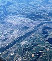 Austria Linz from southwest IMG 9057.JPG 3,456 × 3,982; 9.03 MB
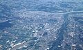 Austria Linz from west IMG 9053.JPG 5,184 × 3,108; 8.65 MB
 Bassin-du-Danube-blank-map.png 1,416 × 741; 123 KB
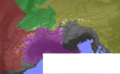
 Bassin-du-Danube.png 1,416 × 741; 98 KB
 Izvorul Dealului River near the Neajlov River.JPG 1,280 × 960; 102 KB
 Schwarza karte.jpg 382 × 373; 41 KB
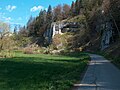 Unterschmeien Felsengruppe Häule 2.jpg 2,608 × 1,952; 3.16 MB
 Waterways of SE Central Europe.svg 1,415 × 1,059; 286 KB


