Category:PD map
Jump to navigation
Jump to search

| NO WIKIDATA ID FOUND! Create new Wikidata item | |
| Upload media |
See the maps section of Commons:Threshold of originality.
Media in category "PD map"
The following 42 files are in this category, out of 42 total.
 2019 UN Human Development Report.svg 512 × 230; 799 KB
.jpg/120px-A_map_of_Europe_to_illustrate_territorial_changes_since_1914_(5003859).jpg) A map of Europe to illustrate territorial changes since 1914 (5003859).jpg 5,000 × 3,912; 2.34 MB
A map of Europe to illustrate territorial changes since 1914 (5003859).jpg 5,000 × 3,912; 2.34 MB
_(5003791).jpg/120px-A_sketch_map_of_the_linguistic_area_of_Europe_(North_East)_(5003791).jpg) A sketch map of the linguistic area of Europe (North East) (5003791).jpg 5,000 × 3,977; 3.2 MB
A sketch map of the linguistic area of Europe (North East) (5003791).jpg 5,000 × 3,977; 3.2 MB
.png/120px-Arabian_Peninsula_(orthographic_projection).png) Arabian Peninsula (orthographic projection).png 2,000 × 2,000; 399 KB
Arabian Peninsula (orthographic projection).png 2,000 × 2,000; 399 KB
 BlankMap-USA-states-Canada-provinces.png 2,289 × 1,744; 29 KB
 BlankMap-USA-states-Canada-provinces.svg 2,289 × 1,744; 211 KB
 Canada blank map.svg 1,304 × 1,263; 113 KB
.svg/120px-Canadian_provinces_and_territories_by_HDI_(2015).svg.png) Canadian provinces and territories by HDI (2015).svg 512 × 493; 103 KB
Canadian provinces and territories by HDI (2015).svg 512 × 493; 103 KB
%2C_score_changes.svg/120px-Countries_by_Human_Development_Index_(2019)%2C_score_changes.svg.png) Countries by Human Development Index (2019), score changes.svg 2,911 × 1,297; 2.09 MB
Countries by Human Development Index (2019), score changes.svg 2,911 × 1,297; 2.09 MB
.png/120px-Countries_by_Human_Development_Index_(2019).png) Countries by Human Development Index (2019).png 6,060 × 2,737; 1.49 MB
Countries by Human Development Index (2019).png 6,060 × 2,737; 1.49 MB
 Countries where Bhojpuri is spoken.png 1,425 × 625; 48 KB
 COVID-19 Cases in California by counties.svg 621 × 733; 258 KB
_by_counties.svg/120px-COVID-19_Cases_in_New_York_(state)_by_counties.svg.png) COVID-19 Cases in New York (state) by counties.svg 512 × 384; 263 KB
COVID-19 Cases in New York (state) by counties.svg 512 × 384; 263 KB
.svg/53px-COVID-19_Cases_in_Sweden_by_Municipality_(Total_Number).svg.png) COVID-19 Cases in Sweden by Municipality (Total Number).svg 290 × 654; 252 KB
COVID-19 Cases in Sweden by Municipality (Total Number).svg 290 × 654; 252 KB
_by_counties.svg/120px-COVID-19_Cases_in_Washington_(state)_by_counties.svg.png) COVID-19 Cases in Washington (state) by counties.svg 512 × 333; 231 KB
COVID-19 Cases in Washington (state) by counties.svg 512 × 333; 231 KB
 COVID-19 in Columbus.svg 733 × 467; 421 KB
 Crisis Trends anxiety map August 2014.png 1,600 × 929; 170 KB
 EC-EU-enlargement animation.gif 680 × 520; 381 KB
 EU Single Market.svg 1,300 × 1,300; 7.36 MB
.svg/120px-Europe_(orthographic_projection).svg.png) Europe (orthographic projection).svg 541 × 541; 239 KB
Europe (orthographic projection).svg 541 × 541; 239 KB
.svg/120px-Europe_orthographic_Caucasus_Urals_boundary_(with_borders).svg.png) Europe orthographic Caucasus Urals boundary (with borders).svg 537 × 536; 342 KB
Europe orthographic Caucasus Urals boundary (with borders).svg 537 × 536; 342 KB
 Europe orthographic Caucasus Urals boundary.svg 537 × 536; 77 KB
 European Union Ukraine Locator.svg 593 × 606; 711 KB
 Gustav Line at Cassino, early 1944.jpg 1,467 × 2,990; 1.81 MB
 Map of Heinrich Göring's travel to Haiti.jpg 1,186 × 770; 296 KB
 Native Americans Race.png 1,749 × 1,740; 124 KB
 Net migration by Nation.png 1,128 × 799; 337 KB
 Per capita income by county.png 1,503 × 792; 681 KB
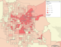
 Poverty in Maricopa County.png 785 × 641; 211 KB
 Poverty Las Vegas Valley.png 850 × 662; 246 KB
 Russia-Subdivisions with Crimea.png 733 × 487; 20 KB
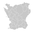 Skåne County Blank Municipality Map.svg 2,039 × 1,845; 86 KB
 UK location in the EU 2016.svg 593 × 606; 702 KB
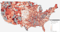
 Unemployment by county in the United States.png 1,328 × 810; 572 KB
 Unemployment rate map of the united states.gif 757 × 403; 35.53 MB
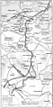
.jpg/120px-Upper_Bari_Doab_Canal_(1911).jpg) Upper Bari Doab Canal (1911).jpg 905 × 661; 263 KB
Upper Bari Doab Canal (1911).jpg 905 × 661; 263 KB
 US bachelor's degree by county in the United States.png 1,460 × 773; 706 KB
 Wierzchuca Nagórna na rosyjskiej mapie półwiorstowej z 1883r.png 2,678 × 1,694; 7.36 MB
 Аляксандар Лукашэнка 1994.png 2,000 × 1,620; 176 KB
.pdf/page1-120px-京成タウンバス_ルートマップ_(三郷線).pdf.jpg) 京成タウンバス ルートマップ (三郷線).pdf 2,480 × 1,753; 1,007 KB
京成タウンバス ルートマップ (三郷線).pdf 2,480 × 1,753; 1,007 KB
.pdf/page1-120px-京成タウンバス_ルートマップ_(三郷線以外).pdf.jpg) 京成タウンバス ルートマップ (三郷線以外).pdf 2,480 × 1,753; 1.31 MB
京成タウンバス ルートマップ (三郷線以外).pdf 2,480 × 1,753; 1.31 MB

.jpg)
_(5003791).jpg)
.png)
.jpg)


.svg)
,_score_changes.svg)
.png)


_by_counties.svg)
.svg)
_by_counties.svg)


.svg)
.svg)


.jpg)


