Category:States of the United States
Jump to navigation
Jump to search

constituent political entity sharing sovereignty as the United States of America  | |||
| Upload media | |||
| Instance of | designation for an administrative territorial entity of a single country, constituency | ||
|---|---|---|---|
| Subclass of | administrative territorial entity of the United States, federated state, first-level administrative country subdivision, constituency | ||
| Location | United States of America | ||
| |||
- States of the United States
- Alabama
- Alaska
- Arizona
- Arkansas
- California
- Colorado
- Connecticut
- Delaware
- Florida
- Georgia (U.S. state)
- Hawaii
- Idaho
- Illinois
- Indiana
- Iowa
- Kansas
- Kentucky
- Louisiana
- Maine
- Maryland
- Massachusetts
- Michigan
- Minnesota
- Mississippi (state) ≈ Mississippi
- Missouri
- Montana
- Nebraska
- Nevada
- New Hampshire
- New Jersey
- New Mexico
- New York (state) ≈ New York
- North Carolina
- North Dakota
- Ohio
- Oklahoma
- Oregon
- Pennsylvania
- Rhode Island
- South Carolina
- South Dakota
- Tennessee
- Texas
- Utah
- Vermont
- Virginia
- Washington (state)
- West Virginia
- Wisconsin
- Wyoming
- District of Columbia
- Washington, D.C.
- the insular areas of the United States ≈ insular areas of the United States
- American Samoa
- Guam
- the Northern Mariana Islands ≈ Northern Mariana Islands
- Puerto Rico
- the United States Virgin Islands ≈ United States Virgin Islands
- the United States Minor Outlying Islands ≈ United States Minor Outlying Islands
- Bajo Nuevo Bank
- Baker Island
- Howland Island
- Jarvis Island
- Johnston Atoll
- Kingman Reef
- Midway Atoll
- Navassa Island
- Palmyra Atoll
- Serranilla Bank
- Wake Island
Subcategories
This category has the following 67 subcategories, out of 67 total.
*
+
.
:
C
D
F
G
H
L
M
N
P
R
S
U
W
~
Media in category "States of the United States"
The following 22 files are in this category, out of 22 total.
 Blank map of states.png 904 × 593; 45 KB
 Iraq 51st US State.jpg 2,048 × 1,539; 500 KB
 Larg US stat.JPG 423 × 342; 51 KB
 Map of the USA with state names in Gothic.png 851 × 631; 66 KB
 Pie chart of US population by state.png 877 × 700; 49 KB
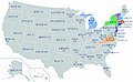 United States Map in Korean.jpg 1,737 × 1,075; 301 KB
 United States map, individual states.jpg 1,102 × 1,442; 226 KB
 United states-map.png 10,000 × 8,000; 8.01 MB
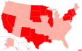 US states by Catholic population.png 2,000 × 1,237; 306 KB
 US states by Evangelical Protestant population.png 2,000 × 1,237; 306 KB
 US states by Mainline or Black Protestant population.png 2,000 × 1,237; 309 KB
 US states by median family income.png 2,000 × 1,237; 306 KB
 US states by median nonfamily income.png 2,000 × 1,237; 306 KB
 US states by non-Christian population.png 2,000 × 1,237; 305 KB
 US states by nonwhite population.png 2,000 × 1,237; 310 KB
 US states by other Christian population.png 2,000 × 1,237; 305 KB
 US states by per capita income.png 2,000 × 1,237; 306 KB
 US states by percentage BAs.png 2,000 × 1,237; 307 KB
 US states by population density.png 2,000 × 1,237; 306 KB
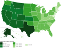
 US states by population growth.png 2,000 × 1,237; 306 KB
 US States by Total Land Area.svg 932 × 723; 113 KB
 USA states on map.png 1,310 × 796; 140 KB


