File:07 - Belfry of Saints Simon and Jude Thaddeus church in Stara Rawa - 01.jpg
Original file (4,896 × 3,672 pixels, file size: 3.03 MB, MIME type: image/jpeg)
Captions
Summary[edit]
Description07 - Belfry of Saints Simon and Jude Thaddeus church in Stara Rawa - 01.jpg |
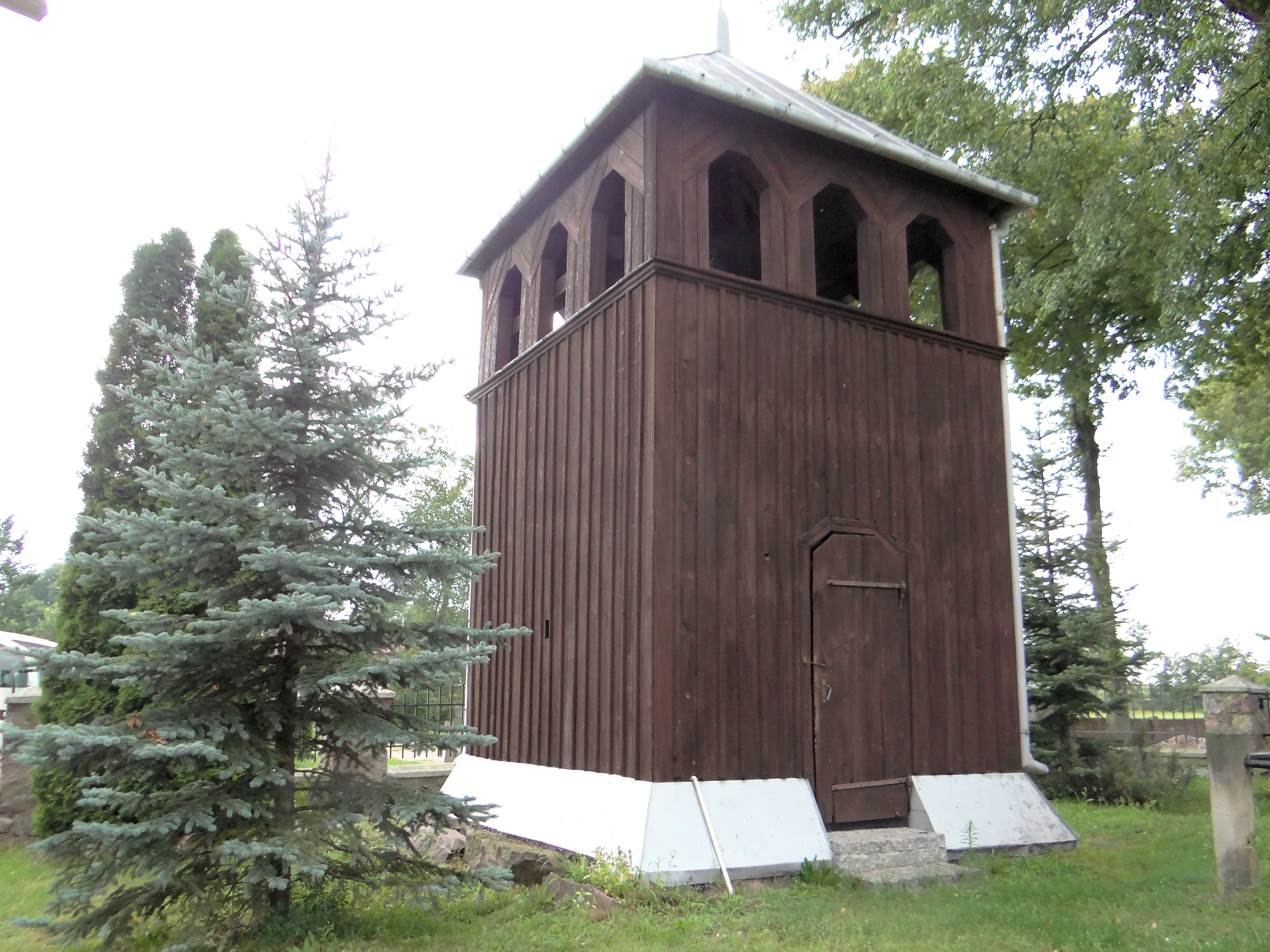
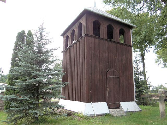
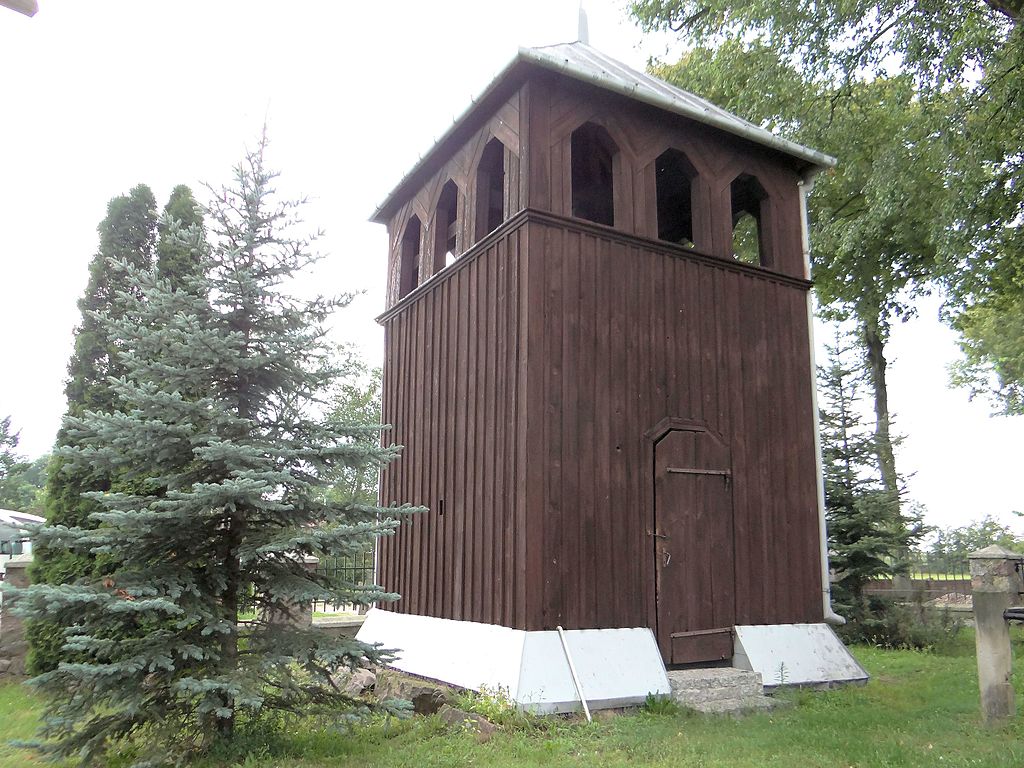
Polski: Stara Rawa, dzwonnica, XVIII - Kościół Świętych Szymona i Judy Tadeusza
English: Belfry of Saints Simon and Jude Thaddeus church in Stara Rawa
|
|
Date | ||
Source | Own work | |
Author | Jolanta Dyr |
Camera location | 51° 52′ 57.29″ N, 20° 16′ 24.51″ E | View this and other nearby images on: OpenStreetMap - Google Earth | 51.882580; 20.273476 |
---|
Licensing[edit]
|
This file is licensed under the Creative Commons Attribution-Share Alike 3.0 Unported license. | |
https://creativecommons.org/licenses/by-sa/3.0 CC BY-SA 3.0 Creative Commons Attribution-Share Alike 3.0 truetrue |
File history
Click on a date/time to view the file as it appeared at that time.
Date/Time | Thumbnail | Dimensions | User | Comment | |
---|---|---|---|---|---|
current | 17:51, 1 August 2016 | 4,896 × 3,672 (3.03 MB) | Jolanta Dyr (talk | contribs) | User created page with UploadWizard |
You cannot overwrite this file.
File usage on Commons
There are no pages that use this file.
File usage on other wikis
The following other wikis use this file:
- Usage on pl.wikipedia.org
- Usage on www.wikidata.org
Metadata
This file contains additional information such as Exif metadata which may have been added by the digital camera, scanner, or software program used to create or digitize it. If the file has been modified from its original state, some details such as the timestamp may not fully reflect those of the original file. The timestamp is only as accurate as the clock in the camera, and it may be completely wrong.
Camera manufacturer | SONY |
---|---|
Camera model | DSC-HX200V |
Exposure time | 1/320 sec (0.003125) |
F-number | f/2.8 |
ISO speed rating | 250 |
Date and time of data generation | 16:22, 30 July 2016 |
Lens focal length | 4.8 mm |
Orientation | Normal |
Horizontal resolution | 350 dpi |
Vertical resolution | 350 dpi |
Software used | Paint Shop Pro Photo 11,20 |
File change date and time | 18:51, 1 August 2016 |
Y and C positioning | Co-sited |
Exposure Program | Normal program |
Exif version | 2.3 |
Date and time of digitizing | 16:22, 30 July 2016 |
Meaning of each component |
|
Image compression mode | 2 |
APEX brightness | 6.65 |
APEX exposure bias | 0 |
Maximum land aperture | 2.96875 APEX (f/2.8) |
Metering mode | Pattern |
Light source | Unknown |
Flash | Flash did not fire, compulsory flash suppression |
Supported Flashpix version | 0,100 |
Color space | sRGB |
File source | Digital still camera |
Scene type | A directly photographed image |
Custom image processing | Normal process |
Exposure mode | Auto exposure |
White balance | Auto white balance |
Digital zoom ratio | 1 |
Scene capture type | Standard |
Contrast | Normal |
Saturation | Normal |
Sharpness | Hard |
Latitude | 51° 52′ 57.29″ N |
Longitude | 20° 16′ 24.51″ E |
Altitude | 27.3 meters above sea level |
GPS time (atomic clock) | 14:22 |
Receiver status | Measurement in progress |
Measurement mode | 3-dimensional measurement |
Measurement precision | Poor (1.67) |
Speed unit | Kilometers per hour |
Speed of GPS receiver | 4.752 |
Reference for direction of movement | True direction |
Direction of movement | 149.86 |
Reference for direction of image | Magnetic direction |
Direction of image | 0.75 |
Geodetic survey data used | WGS-84 |
GPS date | 30 July 2016 |
GPS differential correction | 0 |
GPS tag version | 0.0.3.2 |
IIM version | 2 |