File:1850 Mitchell Map of Arabia, Persia, Afghanistan - Geographicus - Arabia-mitchell-1850.jpg
Original file (3,500 × 2,865 pixels, file size: 2.77 MB, MIME type: image/jpeg)
Captions
Captions
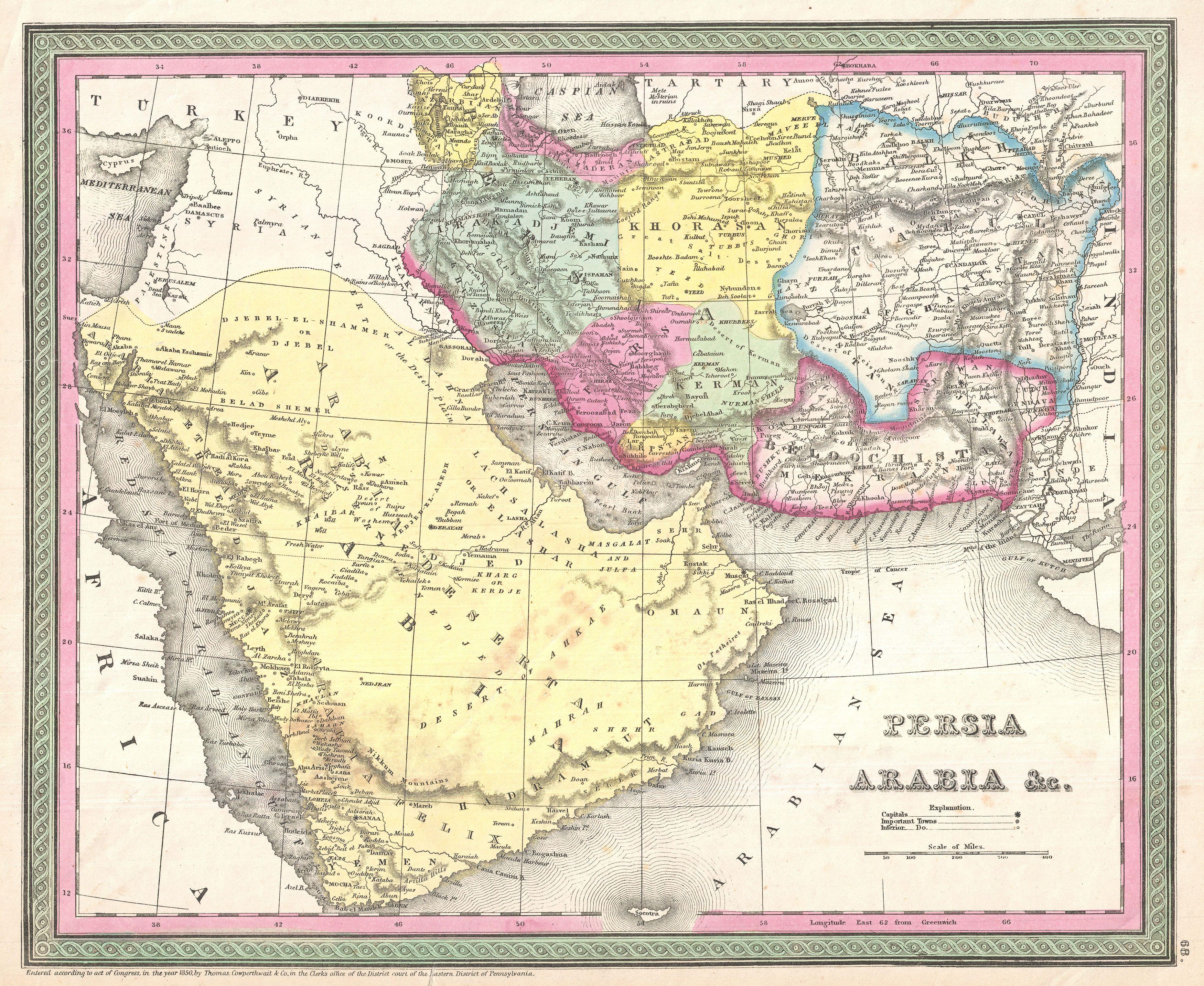
| Title | Persia, Arabia & C. | |||||
| Description |
English: A fine example of S. A. Mitchell Sr.'s important c. 1850 map of Arabia, Persia, and Afghanistan.
|
|||||
| Author | ||||||
| Date | (dated) | |||||
| Source | Mitchell Sr., S. A.,A New Universal Atlas Containing Maps of the various Empires, Kingdoms, States and Republics Of The World. (1850 issue)
|
|||||
| Permission (Reusing this file) |
|
|||||
| Georeferencing | If inappropriate please set warp_status=skip to hide. | |||||
| Archival data | ||||||
| Accession number | Geographicus link: Arabia-mitchell-1850 | |||||
| Dimensions | Height: 12.5 in (31.7 cm); Width: 15.5 in (39.3 cm) | |||||
|
File history
Click on a date/time to view the file as it appeared at that time.
| Date/Time | Thumbnail | Dimensions | User | Comment | |
|---|---|---|---|---|---|
| current | 21:45, 23 March 2011 | | 3,500 × 2,865 (2.77 MB) | BotMultichillT (talk | contribs) | {{subst:User:Multichill/Geographicus |link=http://www.geographicus.com/P/AntiqueMap/Arabia-mitchell-1850 |product_name=1850 Mitchell Map of Arabia, Persia, Afghanistan |map_title=Persia, Arabia & C. |description=A fine example of S. A. Mitchell Sr.'s |
You cannot overwrite this file.
File usage on Commons
There are no pages that use this file.
File usage on other wikis
The following other wikis use this file:
- Usage on fa.wikipedia.org
- ویکیپدیا:نگارههای برگزیده/نقشه
- ویکیپدیا:گزیدن نگاره برگزیده/فوریه-۲۰۱۴
- ویکیپدیا:گزیدن نگاره برگزیده/1850 Mitchell Map of Arabia, Persia, Afghanistan - Geographicus - Arabia-mitchell-1850.jpg
- نقشه خاورمیانه ساموئل آگوستوس میشل
- ویکیپدیا:نگاره روز/دسامبر ۲۰۱۴
- الگو:نر/2014-12-20
- الگو:نر محافظت شده/2014-12-20
- بحث کاربر:Magic Wizard/بایگانی ۱
- Usage on mzn.wikipedia.org