File:Australia satellite plane.jpg

Original file (5,250 × 4,320 pixels, file size: 1.76 MB, MIME type: image/jpeg)
Captions
Captions
| Description | ||||||
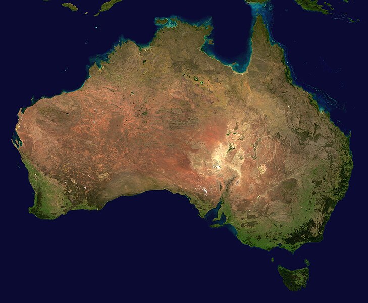
| Source | The image is from here, specifically http://visibleearth.nasa.gov/images/2433/land_shallow_topo_east.tif land_shallow_topo_east.tif, which was cropped at 5250x4320+13390+11880. | |||||
| Author | Reto Stöckl / NASA Goddard Space Flight Center | |||||
| Permission (Reusing this file) |
|
|||||
| Other versions | Derivative works of this file: Australia satellite states.jpg |

|
File history
Click on a date/time to view the file as it appeared at that time.
| Date/Time | Thumbnail | Dimensions | User | Comment | |
|---|---|---|---|---|---|
| current | 16:58, 19 May 2005 | | 5,250 × 4,320 (1.76 MB) | Dbenbenn (talk | contribs) | high resolution version. Cropped land_shallow_topo_east.tif at 5250x4320+13390+11880 |
| 21:10, 13 November 2004 |  | 800 × 672 (84 KB) | Bjarki S (talk | contribs) |
You cannot overwrite this file.
File usage on Commons
The following 4 pages use this file:
File usage on other wikis
The following other wikis use this file:
- Usage on af.wikipedia.org
- Usage on an.wikipedia.org
- Usage on arz.wikipedia.org
- Usage on ast.wikipedia.org
- Usage on azb.wikipedia.org
- Usage on ba.wikipedia.org
- Usage on be-tarask.wikipedia.org
- Usage on be.wikipedia.org
- Usage on bn.wikipedia.org
- Usage on bo.wikipedia.org
- Usage on br.wikipedia.org
- Usage on ca.wikipedia.org
- Usage on ce.wikipedia.org
- Usage on ckb.wikipedia.org
- Usage on cs.wikipedia.org
- Usage on cy.wiktionary.org
- Usage on da.wikipedia.org
- Usage on de.wiktionary.org
- Usage on diq.wikipedia.org
- Usage on dz.wikipedia.org
- Usage on el.wikipedia.org
- Usage on en.wikipedia.org
- Outback
- Talk:Geography of Australia
- Talk:Ballarat
- Talk:Kalgoorlie
- Talk:Fremantle
- Talk:Albury–Wodonga
- Talk:Darling Harbour
- Talk:Geelong
- Talk:Grafton, New South Wales
- Talk:List of cities in Australia
- Talk:Launceston, Tasmania
- Talk:Whyalla
- Talk:Gosford
- Talk:Wollongong
- Talk:List of localities in Victoria
- Talk:List of regions of Australia
- Talk:Kata Tjuta
- Talk:Wedderburn, Victoria
- Talk:Bondi Beach
- Talk:Arthurs Seat, Victoria
View more global usage of this file.