Category:Abbatiale Saint-Nabor de Saint-Avold
Jump to navigation
Jump to search

| Object location | | View all coordinates using: OpenStreetMap - Google Earth - Proximityrama |
|---|
|
This building is en partie classé, en partie inscrit au titre des Monuments Historiques. It is indexed in the Base Mérimée, a database of architectural heritage maintained by the French Ministry of Culture, under the reference PA00106983
|
abbatial church located in Moselle, in France  | |||
| Upload media | |||
| Instance of | abbey church, church building | ||
|---|---|---|---|
| Location | Saint-Avold, canton of Saint-Avold-1, arrondissement of Forbach, Moselle, Grand Est, France | ||
| Diocese | |||
| Heritage designation |
| ||
| Inception |
| ||

| |||
| |||
Subcategories
This category has only the following subcategory.
P
Media in category "Abbatiale Saint-Nabor de Saint-Avold"
The following 48 files are in this category, out of 48 total.
 Abbatiale Chevet.jpg 900 × 912; 419 KB
 Abbaye Saint-Nabor de Saint-Avold.jpg 3,810 × 5,080; 12.11 MB
.jpg/80px-AbteikircheStNaborStAvoldL1110832_(2).jpg) AbteikircheStNaborStAvoldL1110832 (2).jpg 2,520 × 3,776; 1.84 MB
AbteikircheStNaborStAvoldL1110832 (2).jpg 2,520 × 3,776; 1.84 MB
 AbteikircheStNaborStAvoldL1110834.jpg 2,520 × 3,776; 3.99 MB
 AbteikircheStNaborStAvoldL1110835.jpg 2,520 × 3,776; 4.22 MB
 AbteikircheStNaborStAvoldL1110836.jpg 2,520 × 3,776; 3.95 MB
 AbteikircheStNaborStAvoldL1110839.jpg 3,776 × 2,520; 3.95 MB
 AbteikircheStNaborStAvoldL1110842.jpg 2,520 × 3,776; 3.93 MB
 AbteikircheStNaborStAvoldL1110843.jpg 2,520 × 3,776; 4.09 MB
 AbteikircheStNaborStAvoldL1110845.jpg 2,520 × 3,776; 4.04 MB
 AbteikircheStNaborStAvoldL1110846.jpg 2,520 × 3,776; 4.22 MB
 AbteikircheStNaborStAvoldL1110851.jpg 2,520 × 3,776; 3.94 MB
 AbteikircheStNaborStAvoldL1110854.jpg 2,520 × 3,776; 4 MB
 AbteikircheStNaborStAvoldL1110855.jpg 2,520 × 3,776; 4.14 MB
 AbteikircheStNaborStAvoldL1110856.jpg 2,520 × 3,776; 3.98 MB
 AbteikircheStNaborStAvoldL1110857.jpg 3,776 × 2,520; 3.93 MB
 AbteikircheStNaborStAvoldL1110858.jpg 3,776 × 2,520; 3.99 MB
 AbteikircheStNaborStAvoldL1110859.jpg 3,776 × 2,520; 3.85 MB
 AbteikircheStNaborStAvoldL1110860.jpg 2,520 × 3,776; 4.23 MB
 AbteikircheStNaborStAvoldL1110861.jpg 2,520 × 3,776; 3.81 MB
 AbteikircheStNaborStAvoldL1110862.jpg 2,520 × 3,776; 4.18 MB
 AbteikircheStNaborStAvoldL1110864.jpg 2,520 × 3,776; 3.99 MB
 AbteikircheStNaborStAvoldL1110865.jpg 2,520 × 3,776; 3.82 MB
 AbteikircheStNaborStAvoldL1110866.jpg 2,520 × 3,776; 4.06 MB
 AbteikircheStNaborStAvoldL1110867.jpg 2,520 × 3,776; 4.08 MB
 AbteikircheStNaborStAvoldL1110873.jpg 3,776 × 2,520; 3.98 MB
 AbteikircheStNaborStAvoldL1110876.jpg 2,520 × 3,776; 3.78 MB
 Chevet de l'abbatiale Saint-Nabor de Saint-Avold.jpg 5,046 × 3,644; 10.41 MB
 Intérieur de l'église abbatiale Saint-Nabor.jpg 2,560 × 1,920; 2.28 MB
 L'église abbatiale Saint-Nabor.jpg 2,560 × 1,920; 2.09 MB
.jpg/79px-L1110844_(3).jpg) L1110844 (3).jpg 1,628 × 2,471; 767 KB
L1110844 (3).jpg 1,628 × 2,471; 767 KB
.jpg/80px-L1110852_(2).jpg) L1110852 (2).jpg 2,457 × 3,681; 1.87 MB
L1110852 (2).jpg 2,457 × 3,681; 1.87 MB
.jpg/88px-L1110866_(2).jpg) L1110866 (2).jpg 2,260 × 3,082; 1.1 MB
L1110866 (2).jpg 2,260 × 3,082; 1.1 MB
 L1110868.jpg 2,520 × 3,776; 4.14 MB
 L1110877.jpg 3,776 × 2,520; 4.07 MB
.jpg/120px-L1110910_(2).jpg) L1110910 (2).jpg 3,776 × 2,520; 2.19 MB
L1110910 (2).jpg 3,776 × 2,520; 2.19 MB
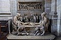
 Mise au tombeau - Abbatiale de Saint-Avold.jpg 3,217 × 2,413; 2.74 MB
.jpg/80px-NaborAvoldL1110850_(2).jpg) NaborAvoldL1110850 (2).jpg 2,520 × 3,776; 2.33 MB
NaborAvoldL1110850 (2).jpg 2,520 × 3,776; 2.33 MB
 Orgue.jpg 564 × 800; 160 KB
 Saint-Avold Abbatiale Saint-Nabor 01.jpg 1,666 × 2,148; 683 KB
 Saint-Avold Abbatiale Saint-Nabor 02.jpg 1,944 × 2,592; 2.01 MB
 Saint-Avold Abbatiale Saint-Nabor 03.jpg 1,944 × 2,592; 1.94 MB
 Saint-Avold Abbatiale Saint-Nabor 04.jpg 1,944 × 2,592; 1.34 MB
 Saint-Avold Abbatiale Saint-Nabor 05.jpg 1,944 × 2,592; 1.86 MB
 Saint-Avold Abbatiale Saint-Nabor 06.jpg 2,592 × 1,944; 1.94 MB
 Saint-Nabor choeur.jpg 3,751 × 2,779; 5.55 MB
 Sculpture romane de Saint-Avold.jpg 1,924 × 2,664; 1.9 MB
 Tour de l'abbatiale Saint-Nabor de Saint-Avold.jpg 3,213 × 4,820; 7.12 MB

.jpg)


.jpg)
.jpg)
.jpg)


.jpg)

.jpg)


Categories:
- Churches in Saint-Avold
- Baroque churches in Moselle
- Abbeys in Moselle
- Benedictine abbeys in Grand Est
- Monasteries established in France in the 6th century
- Christian monasteries established in the 6th century
- Benedictine monasteries established in the 8th century
- Monasteries established in France in the 8th century
- Monasteries established in 765
- Monasteries disestablished in 1792
- Saint Nabor churches in Moselle
- Monuments historiques in Moselle (churches)
- 11th-century churches in Moselle
- Churches in Moselle built in 1790