Category:Abbaye de Lavaudieu
Jump to navigation
Jump to search

| Object location | | View all coordinates using: OpenStreetMap - Google Earth - Proximityrama |
|---|
|
This building is classé au titre des Monuments Historiques. It is indexed in the Base Mérimée, a database of architectural heritage maintained by the French Ministry of Culture, under the reference PA00092685
|
former Benedictine abbey in the Haute-Loire department, France  | |||
| Upload media | |||
| Instance of | abbey | ||
|---|---|---|---|
| Location | Lavaudieu, canton of Brioude-Sud, arrondissement of Brioude, Haute-Loire, Auvergne-Rhône-Alpes, France | ||
| Architectural style | |||
| Headquarters location | |||
| Heritage designation |
| ||

| |||
| |||
Subcategories
This category has the following 3 subcategories, out of 3 total.
A
C
R
Pages in category "Abbaye de Lavaudieu"
The following 2 pages are in this category, out of 2 total.
Media in category "Abbaye de Lavaudieu"
The following 19 files are in this category, out of 19 total.
 F08.Lavaudieu.001010.jpg 2,338 × 1,700; 649 KB
 F08.Lavaudieu.002.JPG 184 × 280; 59 KB
 F08.Lavaudieu.003.JPG 558 × 352; 182 KB
 F08.Lavaudieu.0112.JPG 1,606 × 1,606; 454 KB
 F08.Lavaudieu.0115.JPG 2,592 × 3,872; 2.9 MB
 F08.Lavaudieu.0116.JPG 3,872 × 2,592; 7.02 MB
 F08.Lavaudieu.0117.JPG 2,592 × 3,872; 5.25 MB
 F08.Lavaudieu.0120.JPG 2,436 × 3,654; 2.34 MB
 F08.Lavaudieu.0153.JPG 2,592 × 3,872; 2.71 MB
 F08.Lavaudieu.0226.JPG 2,313 × 3,469; 1.45 MB
 Lavaudieu Abbatiale Saint-André 891.jpg 4,896 × 3,264; 13.48 MB
 Lavaudieu Abbatiale Saint-André 892.jpg 4,896 × 3,264; 13.27 MB
 Lavaudieu Abbatiale Saint-André 893.jpg 4,896 × 3,264; 16.79 MB
 Lavaudieu Abbatiale Saint-André 894.jpg 3,264 × 4,896; 15.67 MB
 Lavaudieu Abbatiale Saint-André 895.jpg 3,264 × 4,896; 14.07 MB
 Lavaudieu Abbatiale Saint-André 896.jpg 3,264 × 4,896; 17.36 MB
 Lavaudieu Abbey cloisters n08.jpg 2,557 × 3,848; 11.78 MB
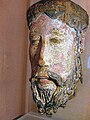 Lavaudieu christ.jpg 450 × 600; 86 KB
 Lavaudieu.1.jpg 2,338 × 1,700; 683 KB


