Category:English Channel
Jump to navigation
Jump to search

Brezhoneg: Mor Breizh
English: the English Channel
Français : La Manche
Русский: Ла-Манш — пролив между побережьем Франции и островом Великобритания.
arm of the Atlantic Ocean that separates southern England from northern France  | |||
| Upload media | |||
| Instance of | strait, sea | ||
|---|---|---|---|
| Part of | Atlantic Ocean | ||
| Named after | |||
| Location | North Sea | ||
| Located on terrain feature | North Sea | ||
| Length |
| ||
| Drainage basin | |||
| Basin country | |||
| Tributary | |||

| |||
| |||
Subcategories
This category has the following 22 subcategories, out of 22 total.
*
B
C
D
E
G
I
L
M
P
R
S
T
W
Pages in category "English Channel"
The following 2 pages are in this category, out of 2 total.
Media in category "English Channel"
The following 172 files are in this category, out of 172 total.
.JPG/120px-0_Escalles_-_Le_Cap_Blanc-Nez_(2).JPG) 0 Escalles - Le Cap Blanc-Nez (2).JPG 5,184 × 3,456; 7.08 MB
0 Escalles - Le Cap Blanc-Nez (2).JPG 5,184 × 3,456; 7.08 MB
 0 La Pointe aux Oies et la Manche - Wimereux.JPG 3,456 × 2,304; 4.79 MB
.JPG/120px-0_Le_Cap_Blanc-Nez_et_la_Manche_vus_de_Tardinghen_(1).JPG) 0 Le Cap Blanc-Nez et la Manche vus de Tardinghen (1).JPG 3,456 × 2,304; 6.2 MB
0 Le Cap Blanc-Nez et la Manche vus de Tardinghen (1).JPG 3,456 × 2,304; 6.2 MB
.JPG/120px-0_Le_Cap_Blanc-Nez_et_la_Manche_vus_du_cimetière_de_Tardinghen_(1).JPG) 0 Le Cap Blanc-Nez et la Manche vus du cimetière de Tardinghen (1).JPG 3,456 × 2,304; 5.88 MB
0 Le Cap Blanc-Nez et la Manche vus du cimetière de Tardinghen (1).JPG 3,456 × 2,304; 5.88 MB
.JPG/120px-0_Tardinghen_-_Site_des_Deux_Caps_et_Ferme_de_la_Source_(1).JPG) 0 Tardinghen - Site des Deux Caps et Ferme de la Source (1).JPG 3,401 × 2,220; 4.65 MB
0 Tardinghen - Site des Deux Caps et Ferme de la Source (1).JPG 3,401 × 2,220; 4.65 MB
.JPG/120px-0_Tardinghen_-_Site_des_Deux_Caps_et_Ferme_de_la_Source_(2).JPG) 0 Tardinghen - Site des Deux Caps et Ferme de la Source (2).JPG 3,438 × 2,278; 5.22 MB
0 Tardinghen - Site des Deux Caps et Ferme de la Source (2).JPG 3,438 × 2,278; 5.22 MB
.JPG/120px-0_Tardinghen_-_Site_des_Deux_Caps_et_Ferme_de_la_Source_(3).JPG) 0 Tardinghen - Site des Deux Caps et Ferme de la Source (3).JPG 3,456 × 2,304; 5.51 MB
0 Tardinghen - Site des Deux Caps et Ferme de la Source (3).JPG 3,456 × 2,304; 5.51 MB
.jpg/82px-Early_flight_02562u_(7).jpg) Early flight 02562u (7).jpg 972 × 1,422; 1.31 MB
Early flight 02562u (7).jpg 972 × 1,422; 1.31 MB
 Jeffries balloon.jpg 362 × 600; 50 KB
 Two men are inside the basket of a hot-air balloon. Coloured Wellcome V0040866.jpg 2,244 × 3,397; 4.19 MB
 Cherbourg 16.JPG 1,336 × 1,964; 1.31 MB
 190324-N-JX484-123 - Flickr - U.S. Department of Defense Current Photos.jpg 3,133 × 2,086; 1.53 MB
 A break in the clouds - possibly - geograph.org.uk - 1118918.jpg 491 × 640; 40 KB
 A New catamaran expedition!! LCCN94501555.jpg 5,060 × 4,099; 2.6 MB
 A New catamaran expedition!! LCCN94501555.tif 5,060 × 4,099; 19.78 MB
 Above the channel.jpg 533 × 400; 95 KB
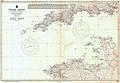 Admiralty Chart No 2649 English Channel Western Portion Published 1955.jpg 10,569 × 7,341; 8.63 MB
 Admiralty Chart No 2675c English Channel Eastern Part, Published 1885.jpg 11,222 × 16,467; 18.52 MB
.jpg/120px-All_Pu_All_Pu_All_Pu_All_Pu_All_P_(8574524096).jpg) All Pu All Pu All Pu All Pu All P (8574524096).jpg 600 × 450; 31 KB
All Pu All Pu All Pu All Pu All P (8574524096).jpg 600 × 450; 31 KB
 Apache Helicopter Operations on HMS Ark Royal MOD 45151993.jpg 4,116 × 2,780; 959 KB
 Apache Helicopter Operations on HMS Ark Royal MOD 45151995.jpg 3,600 × 2,400; 747 KB
 Apache Helicopter Operations on HMS Ark Royal MOD 45151996.jpg 3,000 × 2,400; 892 KB
 Apache Helicopter Operations on HMS Ark Royal MOD 45151998.jpg 3,600 × 2,400; 1.09 MB
 Apache Helicopter Operations on HMS Ark Royal MOD 45151999.jpg 3,000 × 2,400; 441 KB
 App-1.jpg 720 × 1,280; 125 KB
 Aquada.jpg 1,024 × 703; 196 KB
 Beechey Tide Chart of the English, Irish and Bristol Channels Ingoing dated 1848.tif 8,325 × 4,061; 1.65 MB
 Beechey Tide Chart of the English, Irish and Bristol Channels Outgoing dated 1848.tif 8,226 × 4,079; 1.65 MB
 Big red boat going about its business.jpg 1,280 × 960; 158 KB
 Bill Burgess en 1906.jpg 234 × 638; 58 KB
 Bill Burgess en 1911.jpg 193 × 703; 44 KB
.jpg/90px-Bill_Burgess%2C_et_ses_lunettes_de_motard_(1911).jpg) Bill Burgess, et ses lunettes de motard (1911).jpg 496 × 661; 54 KB
Bill Burgess, et ses lunettes de motard (1911).jpg 496 × 661; 54 KB
 Bognor Regis Beach English Channel United Kingdom.jpg 1,635 × 1,920; 3.32 MB
 Brading Down and the English Channel from Southern Vectis route 10 bus 2.JPG 3,712 × 2,088; 2.98 MB
 Brading Down and the English Channel from Southern Vectis route 10 bus 3.JPG 3,712 × 2,088; 2.79 MB
 Brading Down and the English Channel from Southern Vectis route 10 bus.JPG 3,712 × 2,088; 2.87 MB
 Brighton Beach at Night.JPG 3,840 × 2,160; 1.89 MB
 British Territorial Waters - panoramio.jpg 2,204 × 3,920; 1.41 MB
 Brojen after completing Channel swim.jpg 151 × 144; 4 KB
 CALAIS DOUVRES. 1881 - Sjöhistoriska museet - Fo29648A.jpg 4,711 × 3,267; 15.41 MB
 CALAIS DOUVRES. 1881 - Sjöhistoriska museet - Fo29648A.tif 4,711 × 3,267, 2 pages; 44.06 MB
 Castle Church and Harbour.JPG 2,048 × 1,536; 683 KB
 Channel sunrise.jpg 640 × 480; 31 KB
 CharlesBaude-Podoscaphe-1878.jpg 1,600 × 1,020; 494 KB
 Clouds and Shadows From an Airplane Over the English Channel.JPG 1,600 × 1,200; 439 KB
 CMA CGM Andromeda Strait of Dover passage.jpg 4,000 × 2,248; 983 KB
.jpg/120px-Container_Schiff_(5312553155).jpg) Container Schiff (5312553155).jpg 2,560 × 1,440; 1.8 MB
Container Schiff (5312553155).jpg 2,560 × 1,440; 1.8 MB
 COTE MORISSE SUD le havre.JPG 2,144 × 1,424; 1.59 MB
.JPG/120px-Coucher_de_soleil_sur_la_Manche_vu_de_Dieppe_(été_2018).JPG) Coucher de soleil sur la Manche vu de Dieppe (été 2018).JPG 2,023 × 1,508; 888 KB
Coucher de soleil sur la Manche vu de Dieppe (été 2018).JPG 2,023 × 1,508; 888 KB
.JPG/120px-Coucher_de_soleil_sur_la_Manche_à_Dieppe_(été_2018).JPG) Coucher de soleil sur la Manche à Dieppe (été 2018).JPG 3,264 × 2,448; 4.47 MB
Coucher de soleil sur la Manche à Dieppe (été 2018).JPG 3,264 × 2,448; 4.47 MB
._White_cliffs_of_Dover_in_background.jpg/120px-Crossing_the_English_Channel_(Le_Manche)._White_cliffs_of_Dover_in_background.jpg) Crossing the English Channel (Le Manche). White cliffs of Dover in background.jpg 1,760 × 1,168; 323 KB
Crossing the English Channel (Le Manche). White cliffs of Dover in background.jpg 1,760 × 1,168; 323 KB
 Dal castello di Dover.jpg 1,588 × 1,028; 762 KB
- De-Ärmelkanal.ogg 2.1 s; 21 KB
 Deal beach.jpg 4,288 × 2,848; 3.01 MB
 Deal Seaways in English Channel.jpg 1,912 × 1,440; 856 KB
 Dover castle1.jpg 4,288 × 2,848; 3.34 MB
 Dover castle2.jpg 4,288 × 2,848; 3.25 MB
 Eastbourne Seafront Pier.jpg 2,896 × 1,936; 2.42 MB
.jpg/120px-English_Channel_(20562846383).jpg) English Channel (20562846383).jpg 5,472 × 3,648; 11.28 MB
English Channel (20562846383).jpg 5,472 × 3,648; 11.28 MB
 English Channel and Bonchurch from Southern Vectis route 3 bus 2.JPG 3,712 × 2,088; 2.94 MB
 English Channel and Bonchurch from Southern Vectis route 3 bus.JPG 3,712 × 2,088; 3.15 MB
 English channel from air.jpg 1,922 × 566; 109 KB
 English Channel from Isle of Wight Coastal path near Niton 2.JPG 4,592 × 3,056; 3.02 MB
 English Channel from Isle of Wight Coastal path near Niton.JPG 4,592 × 3,056; 4.26 MB
 English Channel from Military Road at Afton Down 2.JPG 3,712 × 2,088; 3.11 MB
 English Channel from Military Road at Afton Down.JPG 3,712 × 2,088; 3.21 MB
 English Channel from Pointe du Hoc.jpg 5,966 × 3,967; 2.13 MB
 English Channel from Southern Vectis Island Coaster bus 2.JPG 3,072 × 2,304; 2.35 MB
 English Channel from Southern Vectis Island Coaster bus.JPG 3,072 × 2,304; 2.38 MB
 English Channel from Southern Vectis route 7 bus.JPG 3,712 × 2,088; 2.55 MB
 English Channel from Ventnor Whitwell Road during snow December 2010.JPG 4,592 × 3,056; 4.73 MB
 Evening skies at sea 20160712 210436.jpg 3,200 × 2,400; 2.07 MB
 Evening skies at sea 20160712 214443.jpg 3,200 × 2,400; 1.68 MB
 Fishing Deal.jpg 4,288 × 2,848; 2.94 MB
.JPG/120px-Fleurs_des_falaises_du_Tréport_devant_la_Manche_(été_2018).JPG) Fleurs des falaises du Tréport devant la Manche (été 2018).JPG 3,264 × 2,448; 5.07 MB
Fleurs des falaises du Tréport devant la Manche (été 2018).JPG 3,264 × 2,448; 5.07 MB
 FMIB 32995 Herring Fishing in the Channel.jpeg 450 × 450; 87 KB
 FMIB 37520 Phare situe a l'extremite d'une jetee, dans un port de la Manche.jpeg 1,476 × 680; 439 KB
 FMIB 43856 Depth of the English Channel.jpeg 895 × 732; 175 KB
 Fouace - départ pour jersey.jpg 2,370 × 1,944; 551 KB
 France & Colonies-1894-estuaire de la Seine.jpg 7,384 × 4,808; 6.71 MB
 FranceGrisNez2Dover.jpg 3,481 × 1,479; 1.6 MB
 French NH90 Caiman Helicopter Landing Onboard HMS Illustrious MOD 45154597.jpg 2,400 × 3,000; 453 KB
 G. Bruno - Le Tour de la France par deux enfants p252.jpg 1,192 × 812; 284 KB
 GBAVUsolarballoon.jpg 1,024 × 1,466; 286 KB
 Gertrude Ederle.jpg 3,618 × 2,704; 1.16 MB
 GLDA.jpg 214 × 71; 6 KB
- Goury.ogv 24 s, 640 × 480; 3.26 MB
 Guines-blanchard02.JPG 1,536 × 2,048; 469 KB
 Hermdunord.jpg 1,087 × 783; 75 KB
 HMS Daring at Sea MOD 45151268.jpg 2,400 × 3,000; 1.18 MB
 HMSExplorer2004.jpg 520 × 316; 51 KB
.jpg/120px-Hochseeschlepper_MS_ESVAGT_(3611084461).jpg) Hochseeschlepper MS ESVAGT (3611084461).jpg 2,560 × 1,440; 1.4 MB
Hochseeschlepper MS ESVAGT (3611084461).jpg 2,560 × 1,440; 1.4 MB
 Hubert Latham Statue.jpg 2,292 × 1,661; 1.72 MB
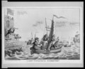
.jpg/120px-Isaac_Cruikshank_-_A_New_Catamaran_Expedition%21%21%21_(1805).jpg) Isaac Cruikshank - A New Catamaran Expedition!!! (1805).jpg 886 × 622; 233 KB
Isaac Cruikshank - A New Catamaran Expedition!!! (1805).jpg 886 × 622; 233 KB
.png/120px-Isaac_Cruikshank_-_A_New_Catamaran_Expedition%21%21%21_(1805).png) Isaac Cruikshank - A New Catamaran Expedition!!! (1805).png 886 × 622; 1.27 MB
Isaac Cruikshank - A New Catamaran Expedition!!! (1805).png 886 × 622; 1.27 MB
 Kanal La Manche s popisem.jpg 3,328 × 1,728; 1.3 MB
 Kanal-Tunnel.jpg 2,122 × 2,761; 2.97 MB
.JPG/120px-La_Manche_au_large_de_Granville_(19_août_2019).JPG) La Manche au large de Granville (19 août 2019).JPG 3,264 × 2,448; 3.94 MB
La Manche au large de Granville (19 août 2019).JPG 3,264 × 2,448; 3.94 MB
.JPG/120px-La_Manche_à_marée_basse_sur_la_plage_de_Dieppe_(été_2018).JPG) La Manche à marée basse sur la plage de Dieppe (été 2018).JPG 2,048 × 1,536; 1.69 MB
La Manche à marée basse sur la plage de Dieppe (été 2018).JPG 2,048 × 1,536; 1.69 MB
 Lilian G. Harrison et Thomas W. 'Bill' Burgess en 1924.jpg 816 × 642; 103 KB
 Louis Meijer - Storm in het Nauw van Calais.jpg 2,500 × 1,865; 1.29 MB
.jpg/120px-Fishery_Protection_Vessel_HMS_Mersey_(8554347647).jpg) Fishery Protection Vessel HMS Mersey (8554347647).jpg 1,000 × 668; 189 KB
Fishery Protection Vessel HMS Mersey (8554347647).jpg 1,000 × 668; 189 KB
.jpg/80px-Fishery_Protection_Vessel_HMS_Mersey_(8555456600).jpg) Fishery Protection Vessel HMS Mersey (8555456600).jpg 668 × 1,000; 147 KB
Fishery Protection Vessel HMS Mersey (8555456600).jpg 668 × 1,000; 147 KB
 Fishery Protection Vessel HMS Mersey MOD 45155102.jpg 1,806 × 2,709; 1.32 MB
 Military Road at Afton Down 3.JPG 3,712 × 2,088; 3.16 MB
 Military Road at Afton Down 4.JPG 3,712 × 2,088; 3.11 MB
 Military Road at Afton Down.JPG 3,712 × 2,088; 3.28 MB
 MV Energy Challenger 310817.jpg 2,048 × 1,366; 2.5 MB
 Olau Line.jpg 2,500 × 1,611; 4.02 MB
 Opera Momentaufnahme 2019-07-19 145706 www.stadtplan.de Opalküste.png 449 × 569; 322 KB
.JPG/120px-Panorama_Nord_de_la_Pointe_du_Roc_à_Granville_(août_2019).JPG) Panorama Nord de la Pointe du Roc à Granville (août 2019).JPG 8,112 × 1,920; 8.21 MB
Panorama Nord de la Pointe du Roc à Granville (août 2019).JPG 8,112 × 1,920; 8.21 MB
.JPG/120px-Panorama_sur_la_Manche_depuis_les_falaises_du_Tréport_(été_2018).JPG) Panorama sur la Manche depuis les falaises du Tréport (été 2018).JPG 8,098 × 1,854; 8.04 MB
Panorama sur la Manche depuis les falaises du Tréport (été 2018).JPG 8,098 × 1,854; 8.04 MB
 Pointe du Hoc barbelés.jpg 4,493 × 2,990; 10.26 MB
_in_the_English_Channel-Strait_of_Dover-3845.jpg/120px-Polaris_Beauty_(IMO_9470143)_in_the_English_Channel-Strait_of_Dover-3845.jpg) Polaris Beauty (IMO 9470143) in the English Channel-Strait of Dover-3845.jpg 4,293 × 2,415; 5.2 MB
Polaris Beauty (IMO 9470143) in the English Channel-Strait of Dover-3845.jpg 4,293 × 2,415; 5.2 MB
.jpg/120px-President_Trump_at_DDay75_(48015957441).jpg) President Trump at DDay75 (48015957441).jpg 1,200 × 800; 522 KB
President Trump at DDay75 (48015957441).jpg 1,200 × 800; 522 KB
.jpg/77px-Quand_le_soleil_est_d%27or%2C_la_mer_est_d%27argent_-_Steve.©_-_(7537436058).jpg) Quand le soleil est d'or, la mer est d'argent - Steve.© - (7537436058).jpg 2,690 × 4,170; 3.38 MB
Quand le soleil est d'or, la mer est d'argent - Steve.© - (7537436058).jpg 2,690 × 4,170; 3.38 MB
 Queen Mary 2 Bootdeck.jpg 2,560 × 1,920; 3.07 MB
 Robida vingtieme siecle p235 1.jpg 1,107 × 756; 223 KB
 ROYAL NAVY FRIGATE ESCORTS RUSSIAN SHIP THROUGH ENGLISH CHANNEL MOD 45164076.jpg 2,782 × 1,855; 1.38 MB
.jpg/99px-Rye_Harbour_(16154783492).jpg) Rye Harbour (16154783492).jpg 3,312 × 4,018; 2 MB
Rye Harbour (16154783492).jpg 3,312 × 4,018; 2 MB
 Sandown MMB 01.jpg 3,903 × 2,184; 2.23 MB
 Sandown MMB 04.jpg 4,044 × 2,424; 2.64 MB
 Seamarlin in the English Channel-Strait of Dover-3839.jpg 4,328 × 2,435; 4.99 MB
_in_the_English_Channel-Strait_of_Dover-3832.jpg/120px-Seychelles_Pioneer_(IMO_9255517)_in_the_English_Channel-Strait_of_Dover-3832.jpg) Seychelles Pioneer (IMO 9255517) in the English Channel-Strait of Dover-3832.jpg 3,676 × 2,068; 3.65 MB
Seychelles Pioneer (IMO 9255517) in the English Channel-Strait of Dover-3832.jpg 3,676 × 2,068; 3.65 MB
 Sotteville sur Mer – Normandie – 360° drone panorama.jpg 6,144 × 3,072; 4.14 MB
 Ss Mangerton strikes Josephine Willis.jpg 1,247 × 867; 368 KB
 St Micheals Mount Marazion.jpg 3,872 × 2,592; 3.22 MB
 Strait of dover STS106-718-28.jpg 4,094 × 4,094; 929 KB
 Sunset at Selsey beach 6.jpg 2,048 × 1,365; 140 KB
 The channel dover.jpg 604 × 400; 59 KB
.jpg/78px-The_English_Channel_(2314076139).jpg) The English Channel (2314076139).jpg 504 × 773; 293 KB
The English Channel (2314076139).jpg 504 × 773; 293 KB
 TheChannel.SilentSea.jpg 1,024 × 768; 158 KB
 Times media 24 logo.jpg 180 × 120; 8 KB
 Top of Cowleaze bus stop from Southern Vectis route 3 bus.JPG 3,712 × 2,088; 3.25 MB
 Torpedo fired from HMAS AUSTRALIA, English Channel.jpg 2,738 × 2,114; 1.05 MB
 Triangulation radiogoniométrie 410 kHz.png 1,223 × 1,003; 1.71 MB
 VazonBayGuernsey.jpg 3,264 × 2,448; 2.92 MB
 View east from Battle of Britain Memorial 0246.JPG 4,608 × 3,456; 5.4 MB
 View east from Battle of Britain Memorial 0254r.JPG 4,295 × 3,221; 1.85 MB
 View east from Battle of Britain Memorial 0258.JPG 4,608 × 3,456; 6.11 MB
 View from Luccombe.jpg 4,128 × 3,096; 6.54 MB
 View In Sea - panoramio.jpg 3,072 × 2,304; 1.85 MB
 View south from Battle of Britain Memorial 0243r.JPG 4,531 × 3,399; 1.86 MB
 View south from Battle of Britain Memorial 0248.JPG 5,760 × 1,080; 3.04 MB
 View south from Battle of Britain Memorial 0266.JPG 5,760 × 1,080; 3.28 MB
 View south from Brightone Holiday Centre.jpg 4,000 × 2,248; 1.07 MB
 View west from Brook Down.JPG 4,000 × 3,000; 3.83 MB
 WEC Vermeer Strait of Dover 310817.jpg 2,048 × 1,365; 2.35 MB
 West Wight seen from Afton Down 3.JPG 3,712 × 2,088; 2.82 MB
 West Wight seen from Afton Down.JPG 3,712 × 2,088; 3.08 MB
.jpg/120px-Admirał_Erich_Raeder_podczas_inspekcji_nad_kanałem_La_Manche_(2-321).jpg) Admirał Erich Raeder podczas inspekcji nad kanałem La Manche (2-321).jpg 3,500 × 2,500; 667 KB
Admirał Erich Raeder podczas inspekcji nad kanałem La Manche (2-321).jpg 3,500 × 2,500; 667 KB
.JPG)

.JPG)
.JPG)
.JPG)
.JPG)
.JPG)
.jpg)
.jpg)
.jpg)


.jpg)


.jpg)


.jpg)

.JPG)
.JPG)
._White_cliffs_of_Dover_in_background.jpg)


.jpg)


.JPG)


.jpg)
_off_the_coast_of_the_White_Cliffs_of_Dover-3849.jpg)


.jpg)
.png)


.jpg)
.JPG)
.JPG)


.jpg)
.jpg)


_in_the_English_Channel-Strait_of_Dover-3845.jpg)
.jpg)
.jpg)


.jpg)


_in_the_English_Channel-Strait_of_Dover-3832.jpg)


.jpg)


,_a_modified_Charles_F._Adams_class_destroyer_from_Kiel,_Germany,_lowers_a.jpg)


.jpg)
.JPG)
.JPG)