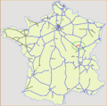
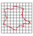
Category:Maps of France
Jump to navigation
Jump to search

Countries of Europe: Albania · Andorra · Armenia‡ · Austria · Azerbaijan‡ · Belarus · Belgium · Bosnia and Herzegovina · Bulgaria · Croatia · Cyprus‡ · Czech Republic · Denmark · Estonia · Finland · France‡ · Georgia‡ · Germany · Greece · Hungary · Iceland · Ireland · Italy · Kazakhstan‡ · Latvia · Liechtenstein · Lithuania · Luxembourg · Malta · Moldova · Monaco · Montenegro · Netherlands‡ · North Macedonia · Norway · Poland · Portugal‡ · Romania · Russia‡ · San Marino · Serbia · Slovakia · Slovenia · Spain‡ · Sweden · Switzerland · Turkey‡ · Ukraine · United Kingdom‡ · Vatican City
Specific status: Akrotiri and Dhekelia‡ · Faroe Islands · Gibraltar · Guernsey · Isle of Man · Jersey – Limited recognition: Abkhazia‡ · Artsakh‡ · Gagauzia · Kosovo · South Ossetia‡ · Transnistria · Turkish Republic of Northern Cyprus‡ · United Nations Buffer Zone in Cyprus‡
‡: partly located in Europe
Use the right category for maps showing all or a large part of France. See subcategories for smaller areas:
| If the map shows | Category to use |
|---|---|
| France on a recently created map | Category:Maps of France or its subcategories |
| France on a map created more than 70 years ago | Category:Old maps of France or its subcategories |
| the history of France on a recently created map | Category:Maps of the history of France or its subcategories |
| the history of France on a map created more than 70 years ago | Category:Old maps of the history of France or its subcategories |
- See also maps needing categories in Category:Unidentified maps
English: Maps of France
Français : Carte de France
Español: Mapas de Francia
Wikimedia category | |||
| Upload media | |||
| Instance of | Wikimedia category | ||
|---|---|---|---|
| Category combines topics | France, map | ||
 | |||
| |||
Subcategories
This category has the following 57 subcategories, out of 57 total.
!
*
A
B
C
D
E
F
G
H
I
L
M
O
P
R
S
T
U
W
Pages in category "Maps of France"
This category contains only the following page.
Media in category "Maps of France"
The following 200 files are in this category, out of 277 total.
(previous page) (next page).jpg/120px-%27ndrangheta_in_Francia_-_Costa_Azzurra_(2017).jpg) 'ndrangheta in Francia - Costa Azzurra (2017).jpg 953 × 745; 114 KB
'ndrangheta in Francia - Costa Azzurra (2017).jpg 953 × 745; 114 KB
.jpg/120px-%27ndrangheta_in_Francia_-_Costa_Azzurra(2017).jpg) 'ndrangheta in Francia - Costa Azzurra(2017).jpg 903 × 680; 103 KB
'ndrangheta in Francia - Costa Azzurra(2017).jpg 903 × 680; 103 KB
 107.7coverage.png 665 × 652; 234 KB
%27_(11038685425).jpg/120px-18_of_%27(A_History_of_the_Romans_under_the_Empire.)%27_(11038685425).jpg) 18 of '(A History of the Romans under the Empire.)' (11038685425).jpg 3,098 × 2,581; 1.53 MB
18 of '(A History of the Romans under the Empire.)' (11038685425).jpg 3,098 × 2,581; 1.53 MB
 2000x2000-GMT France tunnel-Manche.jpg 2,000 × 2,000; 1,006 KB
 20061027 Carte EuroDiag.png 545 × 516; 22 KB
 20120903 Carte des PDM.pdf 1,239 × 1,752; 5.59 MB
.jpg/119px-59_of_%27Leerboek_der_Aardsrijkskunde._Met_Schetskaartjes%2C_etc%27_(11303137184).jpg) 59 of 'Leerboek der Aardsrijkskunde. Met Schetskaartjes, etc' (11303137184).jpg 1,417 × 1,426; 441 KB
59 of 'Leerboek der Aardsrijkskunde. Met Schetskaartjes, etc' (11303137184).jpg 1,417 × 1,426; 441 KB
%27_(11089288904).jpg/120px-71_of_%27Le_Havre%2C_son_passé%2C_son_présent%2C_son_avenir._(With_plates.)%27_(11089288904).jpg) 71 of 'Le Havre, son passé, son présent, son avenir. (With plates.)' (11089288904).jpg 2,352 × 1,605; 1.05 MB
71 of 'Le Havre, son passé, son présent, son avenir. (With plates.)' (11089288904).jpg 2,352 × 1,605; 1.05 MB
 Ancient provinces, France and departments that replaced them. Wellcome M0016661.jpg 3,780 × 2,992; 2.26 MB
 Area de servicio del centre de Francia en la autopista A71.jpg 2,800 × 2,800; 1.44 MB
 Areas where Apothecaries were to be found. Wellcome L0004945.jpg 1,410 × 1,446; 220 KB
_(14577308458).jpg/120px-Battles_of_the_nineteenth_century_(1901)_(14577308458).jpg) Battles of the nineteenth century (1901) (14577308458).jpg 3,168 × 2,280; 1.35 MB
Battles of the nineteenth century (1901) (14577308458).jpg 3,168 × 2,280; 1.35 MB
 Beaupreau.png 640 × 599; 155 KB
 Biodiversité en France.jpg 1,527 × 850; 213 KB
 Biosphere reserves in France.png 2,150 × 1,771; 221 KB
.png/105px-Breizh_(1).png) Breizh (1).png 273 × 312; 84 KB
Breizh (1).png 273 × 312; 84 KB
 Britannica Sedan.jpg 840 × 830; 410 KB
_(14597855570).jpg/82px-Brockhaus%27_Konversations-Lexikon_(1892)_(14597855570).jpg) Brockhaus' Konversations-Lexikon (1892) (14597855570).jpg 1,754 × 2,558; 885 KB
Brockhaus' Konversations-Lexikon (1892) (14597855570).jpg 1,754 × 2,558; 885 KB
 CA Seine Eure dans l'Eure.svg 512 × 424; 143 KB
_CIA_World_Factbook_map.png/112px-Cadarache_(red_dot)_CIA_World_Factbook_map.png) Cadarache (red dot) CIA World Factbook map.png 327 × 350; 15 KB
Cadarache (red dot) CIA World Factbook map.png 327 × 350; 15 KB
 Cannes ichi.png 1,224 × 792; 242 KB
 Capturefr2.png 1,689 × 1,513; 248 KB
 Carte A106.svg 400 × 400; 35 KB
 Carte A131 v2.svg 298 × 141; 54 KB
 Carte A131 v3.jpg 1,860 × 882; 478 KB
 Carte A131.svg 298 × 141; 71 KB
 Carte A132.svg 298 × 141; 54 KB
 Carte A150.svg 298 × 141; 50 KB
 Carte A151.svg 298 × 141; 50 KB
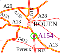 Carte A154.svg 160 × 140; 47 KB
 Carte A30.png 1,353 × 1,347; 287 KB
 Carte A320.svg 500 × 400; 116 KB
 Carte A33.png 1,353 × 1,347; 287 KB
 Carte A34.png 1,353 × 1,347; 286 KB
 Carte A38 v2.png 1,353 × 1,347; 289 KB
 Carte A38.png 1,353 × 1,347; 289 KB
 Carte A404.svg 400 × 265; 34 KB
 Carte A450.svg 400 × 400; 12 KB
 Carte A466.svg 400 × 400; 12 KB
 Carte A81.png 1,353 × 1,347; 286 KB
 Carte A82.svg 400 × 400; 19 KB
 Carte A844 v2.svg 400 × 400; 22 KB
 Carte A844.svg 400 × 400; 22 KB
 Carte Agglo.jpg 409 × 421; 47 KB
 Carte Chalair .jpg 2,500 × 1,855; 1.18 MB
 Carte Chalair 07janv2019.jpg 2,500 × 1,855; 1.16 MB
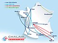 Carte Chalair janvier 2019.jpg 2,500 × 1,855; 1.14 MB
 Carte CMFP,SAINT -MANDRIER.png 746 × 681; 856 KB
.jpg/120px-Carte_d%27implantation_du_Crédit_Mutuel_Arkéa_(2016).jpg) Carte d'implantation du Crédit Mutuel Arkéa (2016).jpg 1,170 × 1,077; 451 KB
Carte d'implantation du Crédit Mutuel Arkéa (2016).jpg 1,170 × 1,077; 451 KB
 CARTE DE FRANCE AFDAS.jpg 2,824 × 2,718; 1.05 MB
 Carte de France Les Castels .png 6,250 × 6,250; 609 KB
 Carte de la cité des Arvernes à l'échelle de la France.png 1,095 × 1,024; 291 KB
 Carte de sur occupation des résidences principales par département.png 1,123 × 794; 109 KB
 Carte des destinations à l'aéroport Nice Côte d'Azur.jpg 5,115 × 1,665; 1.97 MB
 Carte des implantations.jpg 2,000 × 2,560; 303 KB
 Carte des Monts des Flandres.png 3,507 × 2,480; 781 KB
 Carte des regions naturelles de France.JPG 2,648 × 2,455; 2.14 MB
 Carte des regions naturelles de france.jpg 2,648 × 2,455; 3.3 MB
 Carte des Templiers Catholiques de France.jpg 980 × 1,014; 149 KB
 Carte des territoires éligibles 2019.png 715 × 533; 63 KB
 Carte FCBA2015.jpg 800 × 606; 241 KB
 Carte France des Foyers de Charité.gif 370 × 402; 9 KB
 Carte France Komilfo.png 2,810 × 3,219; 433 KB
 Carte Oceania 2013.jpg 842 × 595; 32 KB
 Carte Projet Illustration des communes françaises 02 03 2015.png 5,000 × 10,414; 1.33 MB
 Carte Projet Illustration des communes françaises 06 07 2015.png 5,000 × 10,414; 1.28 MB
 Carte Projet Illustration des communes françaises 08 07 2014.png 5,000 × 3,902; 976 KB
 Carte Projet Illustration des communes françaises 10 03 2014.png 5,000 × 3,595; 1.04 MB
 Carte Projet Illustration des communes françaises 19 11 2014.png 5,000 × 10,416; 789 KB
 Carte quotidiens groupe EBRA.svg 569 × 620; 4.14 MB
 Carte region naturelle.jpg 2,673 × 2,460; 3.2 MB
 Carte revendeurs.jpg 486 × 499; 157 KB
 Carte réseau écoles Arborescences.jpg 1,140 × 1,210; 196 KB
 Carte topographique du Vexin français.jpg 3,507 × 2,480; 1.34 MB
 Carte vigilance MeteoFrance 15-10-2018.svg 520 × 555; 150 KB
 Carte-de-France.jpg 1,454 × 1,352; 2.76 MB
 Carte-France 2018.gif 575 × 564; 24 KB
 Carte-relief-lambert-grandes-villes-Chaumont-en-Vexin.jpg 1,000 × 949; 197 KB
 Cartographie des lieux d'internat d'excellence en France.jpg 585 × 581; 50 KB
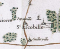 Cassini Map of Saint-Escobille.png 345 × 285; 140 KB
 Cathédrales catholiques romaines de France.png 909 × 1,178; 482 KB
 Ceasar'ın Erken Galya Seferleri.png 555 × 574; 75 KB
 Champagne in the 12th century.jpg 1,000 × 586; 151 KB
 Circonscriptions avec des élections législatives partielles.PNG 846 × 766; 174 KB
.jpg/120px-Citroën_2CV%2C_N7_(1).jpg) Citroën 2CV, N7 (1).jpg 4,608 × 3,456; 3.11 MB
Citroën 2CV, N7 (1).jpg 4,608 × 3,456; 3.11 MB
.jpg/111px-Citroën_2CV%2C_N7_(2).jpg) Citroën 2CV, N7 (2).jpg 2,747 × 2,974; 1.1 MB
Citroën 2CV, N7 (2).jpg 2,747 × 2,974; 1.1 MB
 Comuni costa azzurra ndrangheta 2015.PNG 965 × 625; 301 KB
 Concerts de la tournée Chedid 2015 map.svg 588 × 550; 386 KB
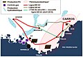 Contexte de Carros.jpg 1,028 × 713; 170 KB
 Covid-19, France, 21 mars 2020.png 2,480 × 2,480; 2.49 MB
 CroquisBasiqueFrance.png 549 × 566; 7 KB
 Côtes de France-es.svg 1,797 × 1,796; 630 KB
 Côtes de France.jpg 2,005 × 1,903; 541 KB
 Côtes de France.png 960 × 720; 387 KB
 Departements.jpg 1,000 × 960; 162 KB
 Dfh-ufa network map.png 980 × 925; 139 KB
 Diocesi di Angers.png 3,071 × 2,488; 514 KB
 Diocesi di Annecy.png 2,469 × 2,138; 598 KB
 Diocesi di Belley-Ars.png 2,849 × 2,587; 757 KB
 Diocesi di Grenoble-Vienne.png 3,343 × 3,272; 568 KB
 Diocesi di Laval.png 2,339 × 2,627; 189 KB
 Diocesi di Le Mans.png 2,741 × 2,752; 480 KB
 Diocesi di Luçon.png 3,461 × 2,280; 455 KB
 Diocesi di Nantes.png 3,089 × 2,753; 508 KB
 Diocesi di Quimper.png 3,272 × 2,776; 515 KB
 Diocesi di Rennes.png 2,481 × 3,036; 459 KB
 Diocesi di Saint Brieuc.png 3,414 × 2,434; 492 KB
 Diocesi di St-Étienne.png 2,268 × 1,908; 145 KB
 Diocesi di Vannes.png 3,308 × 2,811; 566 KB
 Distribució dòlmens angevins.png 495 × 467; 70 KB
 Divisions of France Proposed by William Playfair in 1793.jpg 1,280 × 1,412; 204 KB
 Dombes France.jpg 888 × 641; 83 KB
 Ein Gespräch. der Provence auf der Burg.JPG 4,364 × 5,081; 2.11 MB
 Enora en france.jpg 954 × 768; 142 KB
 Espace metropolitain MaineVal de loire.JPG 500 × 286; 15 KB
 Evolution TFJM.png 434 × 162; 45 KB
 Exemple carte Projet Illustration des communes françaises.png 2,000 × 1,433; 239 KB
_-_Map_Bipalium.png/120px-Figure_01_(PeerJ_4672)_-_Map_Bipalium.png) Figure 01 (PeerJ 4672) - Map Bipalium.png 3,004 × 2,462; 3.59 MB
Figure 01 (PeerJ 4672) - Map Bipalium.png 3,004 × 2,462; 3.59 MB
 Fond-carte-departements.jpg 1,000 × 960; 164 KB
 FR-aires urbaines-2010.png 2,951 × 2,480; 5.36 MB
 FR-communes nouvelles-2020.png 2,946 × 2,480; 1.25 MB
 FR-communes-2020.png 3,410 × 2,930; 6.54 MB
 FR-Communes-EducNat.png 2,946 × 2,480; 4.97 MB
 FR-communes-littoral-2020.png 2,951 × 2,480; 1.96 MB
 FR-communes-loi-littoral-2020.png 2,951 × 2,480; 1.03 MB
 FR-densites-2020-01-01.png 3,519 × 2,930; 6.63 MB
 FR-massifs.png 2,951 × 2,480; 2.24 MB
 FR-montagne-loi.png 2,951 × 2,480; 1.92 MB
 FR-montagne.png 2,951 × 2,480; 2.21 MB
 FR-Précipitations-totales.png 2,480 × 2,480; 1.01 MB
 FR-unités-urbaines.png 3,507 × 2,480; 5.52 MB
 FRAD004-017. Souvenirs d' Élie Jarjayes et Arthur Boucher, item 2.jpg 1,500 × 994; 689 KB
 France - Régions SNEF v4.jpg 1,984 × 1,091; 1.25 MB
.png/120px-France_3_Regions_(Sud).png) France 3 Regions (Sud).png 738 × 692; 11 KB
France 3 Regions (Sud).png 738 × 692; 11 KB
 France affine.gif 225 × 320; 4 KB
 France anticonforme.gif 263 × 288; 4 KB
 France bellwethers.svg 507 × 553; 147 KB
 France borders from 1810 to 1871.gif 466 × 430; 143 KB
 France conforme.gif 263 × 288; 5 KB
.png/120px-France_flag_map_(all_18_regions).png) France flag map (all 18 regions).png 1,920 × 1,080; 20 KB
France flag map (all 18 regions).png 1,920 × 1,080; 20 KB
 France par rotation 180deg.gif 108 × 119; 5 KB
 France svg element for world maps.svg 512 × 410; 6 KB
.jpg/120px-France-2014_-_See_You_in_a_Couple_of_Months_(12269834646).jpg) France-2014 - See You in a Couple of Months (12269834646).jpg 900 × 900; 237 KB
France-2014 - See You in a Couple of Months (12269834646).jpg 900 × 900; 237 KB
 France-hexagon.svg 942 × 953; 15 KB
 France-RéseauRN.png 3,507 × 2,480; 926 KB
 France-Wallonie-avec Bruxelles.svg 678 × 663; 1.14 MB
 France-Wallonie-Bruxelles in red.svg 678 × 663; 1.14 MB
 France-Wallonie-sans Bruxelles.svg 678 × 663; 1.13 MB
 Francia bazala mapo 18 regioni-Ido.png 2,215 × 2,048; 541 KB
 Frankreich Wolfsangriffe auf Menschen.png 702 × 553; 130 KB
 French canals index map.jpg 800 × 763; 590 KB
 French counties of Anjou & Maine and the duchy of aquitaine.png 891 × 899; 13 KB
.png/120px-French_departments_by_legal_population_(2013).png) French departments by legal population (2013).png 6,300 × 6,220; 3.56 MB
French departments by legal population (2013).png 6,300 × 6,220; 3.56 MB
 French radio traffic map.jpg 225 × 228; 28 KB
 French Regions.svg 2,133 × 2,050; 1.48 MB
 Gemeinden Frankreich 2020.png 4,000 × 3,796; 6.24 MB
 Gemeindeverband Astarac Arros en Gascogne 2018.png 3,500 × 2,853; 2.67 MB
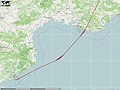 Germanwings Flight 9525 trace.jpg 2,048 × 1,536; 318 KB
 Brique gothique en France.png 895 × 864; 1.36 MB
 Gothique de brique en Flandre-Française.png 715 × 486; 621 KB
 Géomorphologie des côtes de France.png 960 × 768; 201 KB
 GéoTransformation.png 439 × 361; 135 KB
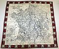 Handkerchief MET 1989.246.15.jpg 728 × 600; 144 KB
 History of the Franks - Frankish Dominions A.D. 511-561.png 3,644 × 2,278; 1.65 MB
 Hydrographie du Soissonnais.png 1,667 × 913; 2.67 MB
 Implantation handirect services.jpg 361 × 539; 23 KB
.png/120px-Implantations_SIMMAD_(25).png) Implantations SIMMAD (25).png 770 × 627; 93 KB
Implantations SIMMAD (25).png 770 × 627; 93 KB
 J,dyjzeftgsdsdsdsdsdsdsdsdsdsdsdsd.gif 950 × 565; 68 KB
 Kaart Minettsbaseng - nl.jpg 700 × 970; 265 KB
 Koart Minettsbaseng.jpg 700 × 973; 346 KB
 La carte des 8 régions FEDEREC.png 650 × 603; 201 KB
 La France vue par.png 642 × 1,386; 172 KB
 La Main de Massiges.jpg 700 × 542; 85 KB
.jpg)
.jpg)
.jpg)

.jpg)
.jpg)
.jpg)
.jpg)
%27_(11038685425).jpg)
.jpg)


.jpg)
.jpg)
.jpg)
.jpg)
.jpg)
_(With_portraits.)%27_(11004914596).jpg)
%27_(11074606516).jpg)
.jpg)
.jpg)
%27_(11303628003).jpg)
.jpg)
.jpg)
.jpg)
%27_(11089288904).jpg)
.jpg)
%27_(11247271524).jpg)
.jpg)


_(14577308458).jpg)


.png)

_(14597855570).jpg)

_CIA_World_Factbook_map.png)


.jpg)


.jpg)
.jpg)


_-_1897.jpg)
_-_Map_Bipalium.png)


.png)


.png)


.jpg)


.png)


.jpg)

.png)


