Category:Notting Hill
Jump to navigation
Jump to search

area of London, England  | |||
| Upload media | |||
| Instance of | area of London | ||
|---|---|---|---|
| Location | Royal Borough of Kensington and Chelsea, Greater London, London, England | ||
| Area |
| ||

| |||
| |||
Subcategories
This category has the following 31 subcategories, out of 31 total.
A
C
G
J
K
L
M
N
P
S
T
W
Media in category "Notting Hill"
The following 59 files are in this category, out of 59 total.
 2005-08-28 - United Kingdom - England - London - Notting Hill - Red Brick 4887683035.jpg 2,585 × 1,788; 2.97 MB
 A3220 and a Mobile Home Site Below - geograph.org.uk - 425193.jpg 640 × 480; 91 KB
 A4206 Pembridge Road - geograph.org.uk - 811898.jpg 640 × 480; 69 KB
 Acklam Road, W10 - geograph.org.uk - 330453.jpg 640 × 480; 124 KB
.jpg/120px-Audi_A6_Avant_and_an_unlucky_bird_(2).jpg) Audi A6 Avant and an unlucky bird (2).jpg 3,072 × 2,304; 1.24 MB
Audi A6 Avant and an unlucky bird (2).jpg 3,072 × 2,304; 1.24 MB
 Audi A6 Avant and an unlucky bird.jpg 3,072 × 2,304; 884 KB
.jpg/120px-Autumn_Foliage_(Unsplash).jpg) Autumn Foliage (Unsplash).jpg 2,500 × 1,656; 1.75 MB
Autumn Foliage (Unsplash).jpg 2,500 × 1,656; 1.75 MB
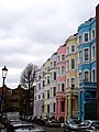
 Blenheim Crescent, W11, The Royal Borough of Kensington and Chelsea.JPG 3,072 × 4,608; 4.07 MB
 Books for Cooks Notting Hill London.JPG 3,343 × 2,850; 2.98 MB
 Cafe Diana - London W2.jpg 2,362 × 1,732; 2.13 MB
 Cafe Diana - Notting Hill, London.jpg 2,362 × 1,732; 2.61 MB
 Cafe Diana behind the Gate.jpg 1,920 × 1,080; 1.86 MB
 Cambridge Gardens W10 - geograph.org.uk - 1485095.jpg 640 × 479; 53 KB
 Caroline Benn blue plaque.jpg 400 × 414; 60 KB
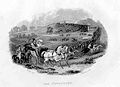
 Environs of London Davies map 1841.jpg 700 × 575; 250 KB
.jpg/120px-Flat_hunters%2C_Notting_Hill_1974_(1922309790).jpg) Flat hunters, Notting Hill 1974 (1922309790).jpg 2,048 × 1,241; 659 KB
Flat hunters, Notting Hill 1974 (1922309790).jpg 2,048 × 1,241; 659 KB
 Flickr - Duncan~ - Callcott Street...jpg 3,847 × 2,872; 2.74 MB
 Football Under The Westway - geograph.org.uk - 420140.jpg 640 × 480; 91 KB
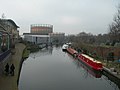 Grand Union Canal, North Kensington - geograph.org.uk - 329861.jpg 640 × 480; 84 KB
 Grenfell Road, W11 - geograph.org.uk - 419407.jpg 640 × 480; 159 KB
.jpg/120px-In_the_gutter%2C_Notting_Hill_1974_(1922300924).jpg) In the gutter, Notting Hill 1974 (1922300924).jpg 2,048 × 1,371; 574 KB
In the gutter, Notting Hill 1974 (1922300924).jpg 2,048 × 1,371; 574 KB
 Kensal Gas Works - geograph.org.uk - 17267.jpg 640 × 480; 101 KB
 Kensington hippodrome.JPG 423 × 308; 12 KB
 Kensington Park Terrace North - geograph.org.uk - 837153.jpg 640 × 551; 122 KB
 Kiln plaque.JPG 776 × 447; 352 KB
 Lansdowne House, Lansdowne Road, W11 - geograph.org.uk - 425706.jpg 480 × 640; 130 KB
 Lansdowne Road Londres.jpg 4,032 × 3,024; 8.12 MB
 London 110.jpg 640 × 480; 333 KB
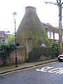 London Bottle Kiln.JPG 1,704 × 2,272; 1.05 MB
 NH Enrico2.jpg 2,655 × 3,543; 3.18 MB
.jpg/90px-Notting_Hill_(2947773318).jpg) Notting Hill (2947773318).jpg 2,112 × 2,816; 3.08 MB
Notting Hill (2947773318).jpg 2,112 × 2,816; 3.08 MB
.jpg/120px-Notting_Hill_(2947786158).jpg) Notting Hill (2947786158).jpg 2,816 × 2,112; 2.43 MB
Notting Hill (2947786158).jpg 2,816 × 2,112; 2.43 MB
.jpg/120px-Notting_Hill_(2947787838).jpg) Notting Hill (2947787838).jpg 2,816 × 1,584; 2.09 MB
Notting Hill (2947787838).jpg 2,816 × 1,584; 2.09 MB
.jpg/90px-Notting_Hill_(2947790126).jpg) Notting Hill (2947790126).jpg 2,112 × 2,816; 2.81 MB
Notting Hill (2947790126).jpg 2,112 × 2,816; 2.81 MB
 Notting Hill - geograph.org.uk - 2552.jpg 640 × 442; 50 KB
 Notting Hill - Pembridge Road.jpg 2,048 × 1,536; 1.29 MB
.jpg/120px-Notting_Hill_Carnival_2017_(36043010863).jpg) Notting Hill Carnival 2017 (36043010863).jpg 5,472 × 3,648; 2.92 MB
Notting Hill Carnival 2017 (36043010863).jpg 5,472 × 3,648; 2.92 MB
 Notting Hill.JPG 3,872 × 2,592; 2.55 MB
.jpg/120px-Old_kiln_in_Notting_Dale_(7480310126).jpg) Old kiln in Notting Dale (7480310126).jpg 1,024 × 768; 880 KB
Old kiln in Notting Dale (7480310126).jpg 1,024 × 768; 880 KB
 Pembridge Road.001 - London.JPG 3,264 × 2,448; 2.92 MB
 PinehurstCourt.jpg 1,010 × 743; 730 KB
 Robinson House, Bramley Road, W10 - geograph.org.uk - 420130.jpg 640 × 480; 143 KB
.jpg/120px-Rude_boys%2C_Notting_Hill_1974_(1922313268).jpg) Rude boys, Notting Hill 1974 (1922313268).jpg 2,048 × 1,371; 534 KB
Rude boys, Notting Hill 1974 (1922313268).jpg 2,048 × 1,371; 534 KB
 Tavistock Road, W11 - geograph.org.uk - 330489.jpg 640 × 480; 126 KB
 Telegraph stamp.jpg 2,744 × 1,658; 952 KB
 The Kensington Hippodrome, 1841.png 474 × 464; 490 KB
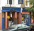 Travel bookshop.jpg 1,794 × 1,635; 706 KB
 Treadgold Street, W11 - geograph.org.uk - 421509.jpg 640 × 480; 119 KB
 Walmer rd kiln.jpg 1,592 × 2,020; 668 KB
 Waynflete Square, W10 - geograph.org.uk - 420169.jpg 640 × 480; 139 KB
 Westway Sports Centre - geograph.org.uk - 420156.jpg 640 × 480; 79 KB
_-_geograph.org.uk_-_330472.jpg/120px-Wornington_Road%2C_W10_(1)_-_geograph.org.uk_-_330472.jpg) Wornington Road, W10 (1) - geograph.org.uk - 330472.jpg 640 × 480; 105 KB
Wornington Road, W10 (1) - geograph.org.uk - 330472.jpg 640 × 480; 105 KB
_-_geograph.org.uk_-_330477.jpg/120px-Wornington_Road%2C_W10_(2)_-_geograph.org.uk_-_330477.jpg) Wornington Road, W10 (2) - geograph.org.uk - 330477.jpg 640 × 480; 127 KB
Wornington Road, W10 (2) - geograph.org.uk - 330477.jpg 640 × 480; 127 KB


.jpg)

.jpg)


.jpg)


.jpg)


.jpg)
.jpg)
.jpg)
.jpg)


.jpg)


.jpg)
_-_geograph.org.uk_-_421093.jpg)
_-_geograph.org.uk_-_421098.jpg)


.jpg)


_-_geograph.org.uk_-_330472.jpg)
_-_geograph.org.uk_-_330477.jpg)