File:1853-Atlanta-Vincent-map.JPG
Jump to navigation
Jump to search


Size of this preview: 545 × 599 pixels. Other resolutions: 218 × 240 pixels | 437 × 480 pixels | 546 × 600 pixels | 699 × 768 pixels | 1,252 × 1,376 pixels.
Original file (1,252 × 1,376 pixels, file size: 644 KB, MIME type: image/jpeg)
Captions
Add a one-line explanation of what this file represents
Captions
Summary[edit]
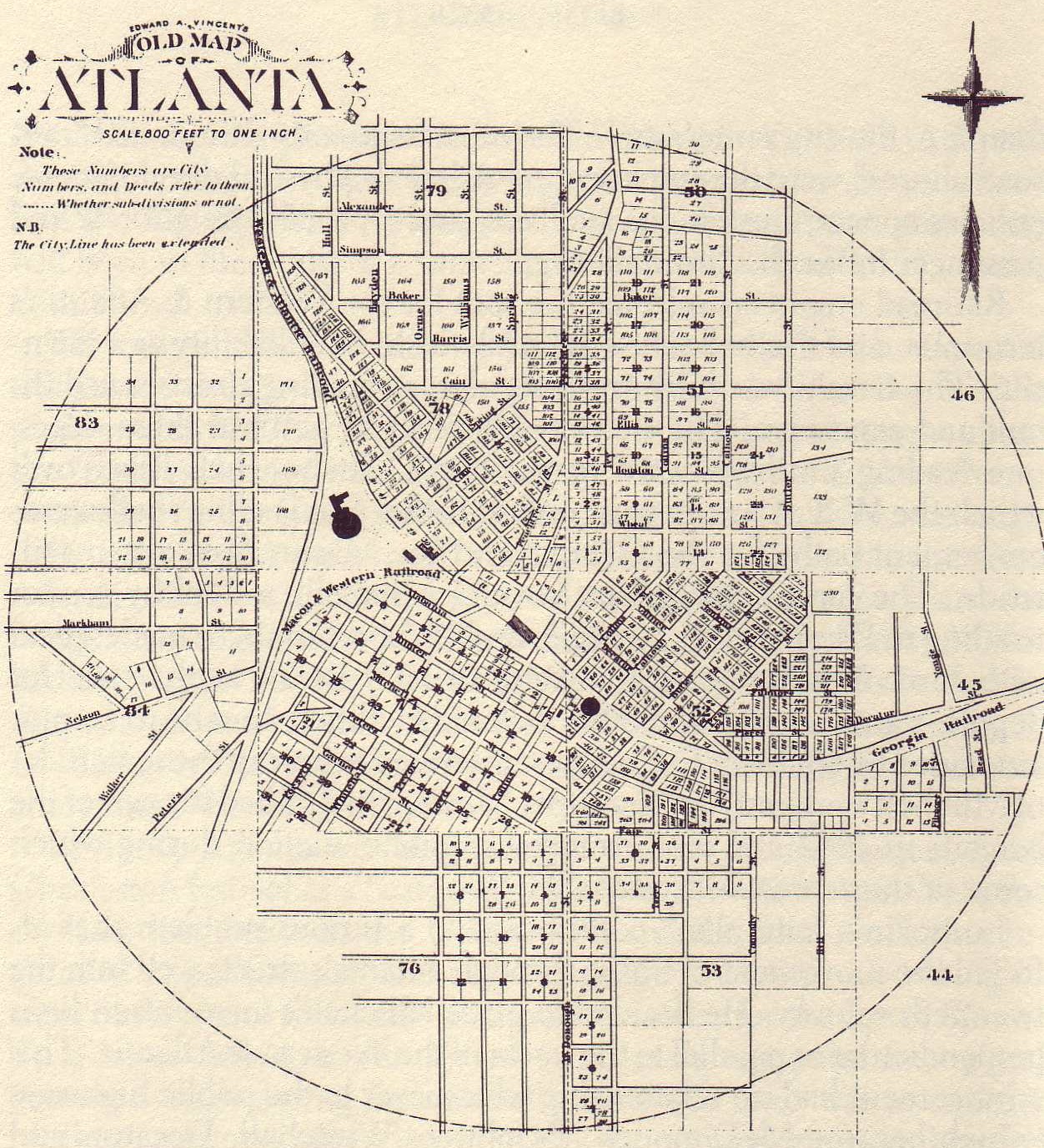
Scanned from a reprint of this 1853 map in the 1878 Atlas. Explains the N.B. that since 1853, the city boundry had been expanded from a one mile circle to one of 1.5 miles.
Licensing[edit]
This media file is in the public domain in the United States. This applies to U.S. works where the copyright has expired, often because its first publication occurred prior to January 1, 1925, and if not then due to lack of notice or renewal. See this page for further explanation.
|
||
This image might not be in the public domain outside of the United States; this especially applies in the countries and areas that do not apply the rule of the shorter term for US works, such as Canada, Mainland China (not Hong Kong or Macao), Germany, Mexico, and Switzerland. The creator and year of publication are essential information and must be provided. See Wikipedia:Public domain and Wikipedia:Copyrights for more details.
|
File history
Click on a date/time to view the file as it appeared at that time.
| Date/Time | Thumbnail | Dimensions | User | Comment | |
|---|---|---|---|---|---|
| current | 20:19, 25 February 2006 | | 1,252 × 1,376 (644 KB) | Jolomo~commonswiki (talk | contribs) | Scanned from a reprint of this 1853 map in the 1878 Atlas. Explains the N.B. that since 1853, the city boundry had been expanded from a one mile circle to one of 1.5 miles. |
You cannot overwrite this file.
File usage on Commons
There are no pages that use this file.
File usage on other wikis
The following other wikis use this file:
- Usage on gl.wikipedia.org